-
 geotagged newsitems feed
Geotagged / Buses
Near me
-
-
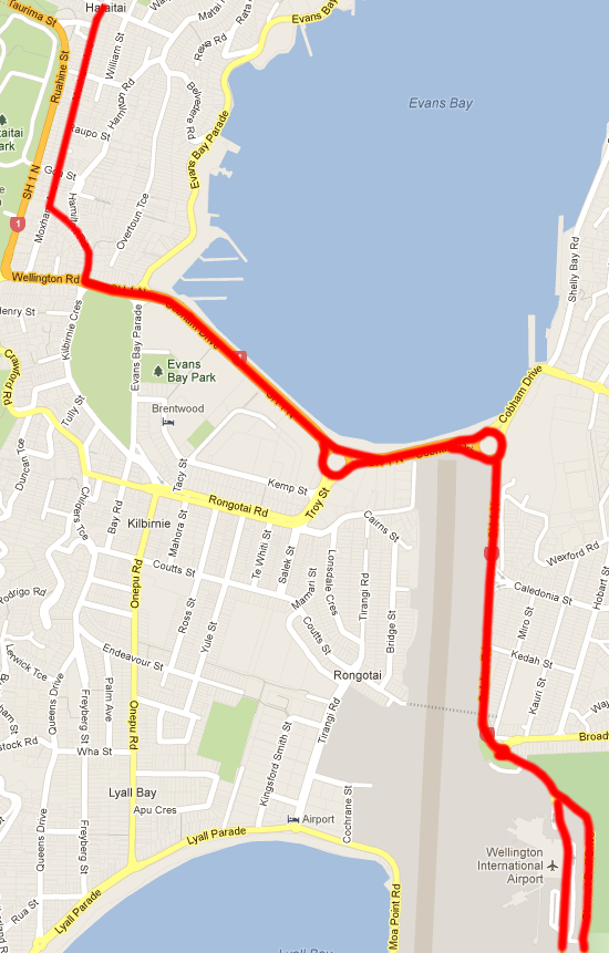
Karori Bus Route 614
- Wellington Girls' College
- We have some important news to share with you regarding Route 614 to Karori. Starting on Wednesday, March 26th, the bus route will be taking a detour due to roadworks on Birdwood St. These roadworks are estimated to last between 3 to 5 months. To help you navigate during this time, a map showing the detour route is available.
- Accepted from WGC 2002 HTTPS by tonytw1
- Tagged as:
- karori
- buses
Birdwood Street, Northland, Wellington, Wellington City, Wellington, 6012, New Zealand (OpenStreetMap)
-
-
-
One million passengers aboard the Airport Express
- Metlink
- Accepted from Metlink News and Updates by feedreader
- Tagged as:
- airport
- buses
Wellington International Airport, Coutts Street, Rongotai, Wellington, Wellington City, Wellington, 6023, New Zealand (OpenStreetMap)
-
-
-
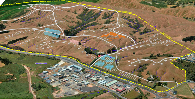
Metlink bus depot plan moving to new location in Miramar
- Wellington International Airport
- Accepted from WIAL press releases by feedreader
- Tagged as:
- miramar
- buses
Wellington International Airport, Stewart Duff Drive, Strathmore Park, Wellington, Wellington City, Wellington, 6242, New Zealand (OpenStreetMap)
-
-
-
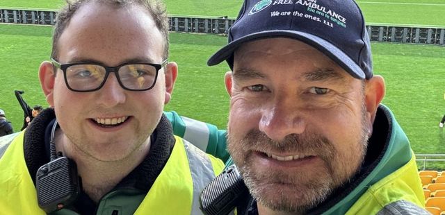
City Bus Service Blindspots: Ōwhiro Bay Residents Develop Killer Calves
- Salient
- Ōwhiro Bay has been abandoned by the bus network, according to a new report. During off-peak times, it takes two buses and over 45 minutes to get from Ōwhiro Bay to the city centre. The suburb is disproportionately affected by bus cancellations. Its residents are fed up. Now, they’ve taken matters into their own hands, writing a twenty-thousand-word report to prove their own experience. Jack Graham and Arunan Noble are both Ōwhiro Bay residents and, in the spirit of full disclosure, friends of the author. They both live with their parents while studying at VUW. After many years of being disappointed by the bus system, hope was initially raised when Metlink announced incoming improvements at the start of 2024.
- Accepted from Salient 2024 by tonytw1
- Tagged as:
- buses
- owhiro-bay
Owhiro Bay, Wellington, Wellington City, Wellington, 6023, New Zealand (OpenStreetMap)
-
-
-
Metlink’s Airport Express set to break 2023 patronage record
- Greater Wellington Regional Council
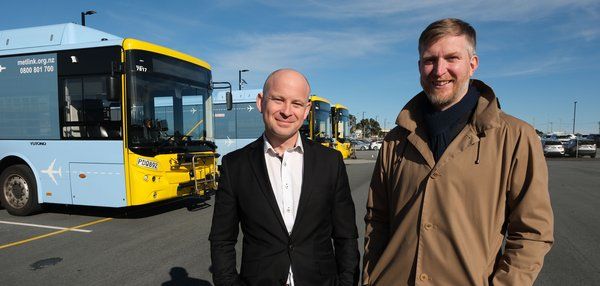
- Eight months since Metlink’s Airport Express exceeded forecast demand, latest patronage figures indicate a new record is poised to be set. 364,191 trips were recorded on the fully electric buses’ first year of operation to 20 July 2023 – 128% of the number expected. With over 320,000 trips already taken in the service’s second year of operation and figures for April and May forecast to be around 36,000 in each month, patronage is set to surpass the 2023 total in just ten months. Greater Wellington chair Daran Ponter say he’s delighted by the patronage growth which underscores Metlink’s commitment to providing efficient and reliable transport options for our residents and visitors alike.
- Accepted from GW news 2022 by feedreader
- Tagged as:
- airport
- buses
- electric-vehicles
Wellington International Airport, Coutts Street, Rongotai, Wellington, Wellington City, Wellington, 6023, New Zealand (OpenStreetMap)
-
-
-
Metlink – update for Term 1 2024
- Wellington High School
- Metlink update – Term 1 2024 Starting 28 January 2024: Buses return to full timetables on routes 1, 7, 23, 24, 25, 29, 32. Route 18 off-peak frequency increases to every 30 minutes, with additional services scheduled for Wellington High School. Morning services leave Karori at 7.46, 8.00 and 8.15 arriving WHS 8.22, 8.36 and […]
- Accepted from WHS 2019 by feedreader
- Tagged as:
- karori
- route-18
Wellington High School, Taranaki Street, Mount Cook, Wellington, Wellington City, Wellington, 6011, New Zealand (OpenStreetMap)
-
-
-
Metlink – update for Term 1 2024
- Wellington High School
- Metlink update – Term 1 2024 Starting 28 January 2024: Buses return to full timetables on routes 1, 7, 23, 24, 25, 29, 32. Route 18 off-peak frequency increases to every 30 minutes, with additional services scheduled for Wellington High School. Morning services leave Karori at 7.46, 8.00 and 8.15 arriving WHS 8.22, 8.36 and […]
- Accepted from WHS news by feedreader
- Tagged as:
- karori
- route-18
Wellington High School, Taranaki Street, Mount Cook, Wellington, Wellington City, Wellington, 6011, New Zealand (OpenStreetMap)
-
-
-
Metlink On Demand bus-hailing service to be extended after successful trial
- Metlink
- A public transport service for the ride-hailing era is expanding in reach. Metlink On Demand, the app-based, demand-driven bus service, will cover a larger area following a decision by Greater Wellington councillors on 22 June. Metlink On Demand finished a successful 12-month trial on 16 May, having completed over 40,000 trips for the community. The trial will now be extended for another year, and the service will be expanded from Tawa and Grenada North to include Porirua CBD. As the trial continues, Metlink will also assess the viability of extending the service to Aotea and Cannons Creek.
- Accepted from Metlink news by feedreader
- Tagged as:
- buses
- tawa
Tawa, Wellington, New Zealand (OpenStreetMap)
-
-
-
Johnsonville: Proposed new bus stop on Moorefield Road
- Metlink
- GWRC is working with Stride and Wellington City Council (WCC) to develop a fully integrated bus and rail transport hub; this is likely to take some time to work through. In the interim, a new bus stop in Johnsonville, southbound on Moorefield Road is proposed - Stop D.
- Accepted from Metlink news by feedreader
- Tagged as:
- johnsonville
- buses
Moorefield Road, Johnsonville, Wellington, Wellington City, Wellington, 6037, New Zealand (OpenStreetMap)
-
-
-
Metlink bike rack practice point encourages cycle savviness
- Greater Wellington Regional Council
- A bus bike rack installed by Greater Wellington allows Wellingtonians to practice attaching their bikes to Metlink buses - without worrying about stopping traffic. The rack is affixed to a near-life-sized image of a Metlink bus on the Bike Space workshop, a city-council sponsored bike repair shop on Cable Street next to Waitangi Park.
- Accepted from GW news 2022 by feedreader
- Tagged as:
- buses
- cycling
Waitangi Park, Te Aro, Wellington, Wellington City, Wellington, New Zealand (OpenStreetMap)
-
-
-
Wellington and Porirua buses to use Saturday timetables in January
- Metlink
- Most Metlink buses in Wellington city and Porirua will use their Saturday timetables on weekdays from 4 to 27 January. Routes 13, 28, 33, 34, 35, 36, 37, 12e, 30x and 31x will operate their normal weekday schedules during this period, while After Midnight services will also operate as normal on Saturday and Sunday mornings Services on routes 81 and 84 between Eastbourne and Wellington are suspended until 29 January. Routes 39 and 32x will also cease operation until 29 January, however, a shuttle will connect Island Bay and Houghton Bay at 10-minute intervals during the morning and evening peaks on weekdays. Metlink has reduced bus timetables in this way to give customers certainty. Because of the national bus driver shortage, and at a time when many of us, including drivers are taking leave, the reduced schedules will help operators meet demand and minimise unplanned cancellations.
- Accepted from Metlink news by feedreader
- Tagged as:
- porirua
- buses
Porirua, Wellington Region, New Zealand (OpenStreetMap)
-
-
-
On-demand public transport launched in Wellington
- Metlink
- On-demand public transport was launched in Wellington for the first time today, as part of a 12-month Metlink trial in the suburb of Tawa. Using a mobile phone app designed by Via, people in Tawa can order rides from buses operating without set routes between flexible pick-up and drop-off locations, or ‘virtual stops’.
- Accepted from Metlink news by feedreader
- Tagged as:
- buses
- tawa
Tawa, Wellington, New Zealand (OpenStreetMap)
-
-
-
Metlink removes service from Wellington Interchange
- Metlink
- Following its latest risk assessments for the parliament protest Metlink is removing all bus services from Lambton Interchange with immediate effect and putting additional detours in place.
- Accepted from Metlink news by feedreader
- Tagged as:
- buses
Lambton Quay, Wellington Central, Wellington, Wellington City, Wellington, 6145, New Zealand (OpenStreetMap)
-
-
-
Plimmerton Farm: getting greenfields right
- Talk Wellington
- If we’re hellbent on doing more residential development in greenfields, what does “decent” look like in Plimmerton, hilly land near an existing suburb – like most of our region’s greenfields? This post is basically a guide for anyone who cares about Plimmerton, good urban development, or healthy wetlands, streams and coast, but is time-poor and can’t face going through the truckloads of documents they’ve stuck up without any specific meta-guidance (some FAQ are here). Hopefully this will help you pop in a submission! PCC’s “information” pages they suggest you use for submitting. Every one of these is a large PDF document, 90% written in technical language… aargh! The background: what where and how For those who don’t know, Plimmerton Farm’s a big proposed subdivision of hilly farmland draining into the significant Taupō Wetland and to Plimmerton Beach, just over the train line and highway from Plimmerton village (original Ngāti Toa name: Taupō). It’s going through a Streamlined Planning Process, a pre-COVID government scheme for accelerating development. The key step is the requisite change of the land’s zoning in the Porirua District Plan (“rural” zone to “residential” and other “urban” zones) that sets out what kind of stuff can then be built, where. It’s mostly streamlined because there’s just one shot for the public to have input on the plan change. One shot. Why submit? I was born and raised in Plimmerton, live here now, and intend to for the rest of my days. I’d love to see it grow, well. I would love Plimmerton to get more wallets, more hearts and minds, more faces (more diverse ones too!). But not with more traffic, and pointless damage to our environment. Right now, the proposal has some serious flaws which need sorting. I say Sorting because the changes won’t make it crazy innovative, just good enough for a development in the spot it is, being kicked off in 2020. Time matters too: there’a a bunch of good things happening imminently (and some bad Porirua trends that need to be reversed). I cover these in Get it right, below. It’s worth submitting because given the situation, a 1990s-grade development just won’t cut it. So what about Plimmerton Farm needs to change? It boils down to two themes: dial down the driveability and dial up the liveabilitymake Local the logical and easy choice for daily needs I’ll outline what needs to change in each. NOTE: There’s a third – don’t stuff the wetlands and streams. This is really important as Taupō Wetland is regionally significant, and all our streams and harbours have suffered from frankly shameful mismanagement of sediment from earthworks-heavy subdivisions like Aotea and Duck Creek, and from the earthworks-a-rama of Transmission Gully. Friends of Taupo Swamp have an excellent submission guide for you – add in some of their suggested bits to your submission. I: Dial down the driveability, dial up the liveability There aren’t many truly black-and-white things in life, but there’s one for towns: If a street is nice to drive in, it’ll be a crappy place to do anything else in (walk / eat / hang out / have a conversation / play / scoot or cycle / shop / have a pint). If it’s nice to do anything else in, it’ll be a crappy place to drive in. Mostly this is because of the nature of the automobile: big solid things that smash into our soft bodies if someone makes a mistake (75% odds of death if that’s at 50km/hour, 10% odds of death if at 30km/hour) big objects that need lots of space for manoeuvering and especially parking – which offstreet can be crazy expensive and push up the cost of a home, and onstreet hoover up valuable public space. big solid things driven by us real humans (for a while at least) who respond to the environment but also get distracted, and generally aren’t good at wielding these big solid things safely. The transport setup proposed for Plimmerton Farm makes for a much too driveable and poorly liveable place. 1. Narrow down all the roads. The current proposal’s roading setup has roads and streets that are too big, and there’s too much of them. Right sized roads for a liveable community The cross-sections for the roads include on-street parking and really wide lane widths. This is really gobsmacking for a consortium that talked a big talk about good practice. For all the reasons that Low Traffic Neighbourhoods are good, this is bad. (And it’s especially nuts when you realise that the excessively wide “arterial” roads (11 metres!) will need earthworked platforms built for them where they’re drawn running up the sharp ridges and across the tops of gullies. Expensive, damaging for the environment, and … what were they thinking?) So recommended changes: NARROW DOWN THE ROADS. Seriously. Design all the living-area streets and roads, and the centre, to be self-explaining for an operating traffic speed of 30km or less – that’s the speed where mistakes are rarely fatal. What does that look like? The designers will know and if they don’t they should be fired. Narrower crossing distances; chicanes (great way to incorporate green infrastructure and trees and seating!); narrowed sight-lines (trees! sculpture!) so no-one driving feels inclined to zoom. Reduced trafficked lanes (rori iti on the larger roads!), with properly wide and friendly footpaths. Threshold treatments, humps, modal filters, all the things we know very well are the natural ways to slow us down when driving, and make streets nicer for people. The beauty of all this “restriction” on driving is how much it frees us up for making everything else appealing. Streets become hospitable for kids to walk, scoot, bike to school safely, using the road not the footpath. Older people and those with impairments can walk and wheelchair safely. Teens coming home from town of an evening can scoot or bike home, safely. Popping down to the shops or for a coffee or to the train becomes a pleasure to do on foot, or on a scooter or bike. And you’re moving in a legitimate way – seeing and being seen, not stuck off in the bush on a “recreational” track like what they’ve described. The ordinary streets and roads are walkable, bikeable, scootable, mobility-scootable, and perfectly driveable, equally safe and useable in all weathers and anytime of day or night. Used to be a big, fast road. Now, kids bike to school and old people can chill out on it. (Mark Kerrison) (And in case you’re worried about firetrucks / rubbish trucks / buses, recall that on even Wellington City’s far more winding, narrower hilly streets everyone gets their rubbish collected and fires fought just fine. On public transport, smaller buses, like those that community transport operators use, are the way of the future for less densely-populated areas like this). Don’t build the through and loop roads. You don’t need signs like this when the only people who bother to drive in are those who live there, or who are visiting friends, because you just have to drive out again the way you came. When it’s the place you live, you’re invested in not being a dick far more than if you’re just out for a drive – or worse, out for a bit of a boyrace hoon on a massive loop route through a whole place. So just don’t build those big connector roads that enable people to drive easily from one residential area to the next, especially the ones up in the hilltops (section C) that just say “come for a hoon!” Instead, connect the living spaces heavily with bikeable, walkable, scootable, disability-friendly streets and lanes, and as much as possible, only one way in and out for cars from each living area. II: Make local logical and easy Plimmerton is a true village, with a great little centre (including a train station!) but Plimmerton Farm is ultimately a damn big area. The way to go is to enable people to get the basics of life – like school, groceries, a coffee – with a little local trip on foot, bike or scooter – it’s more of a bother to get in the car. Right now though, it needs two changes: 1. Provide for a second centre “Bumping into” spaces are known to be crucial to a feeling of neighbourhood, and in the (initial) absence of third places (worship places, community hall, sports club, cafe/pub, a supermarket is a vital social centre. Yet the north end of Plimmerton Farm is currently a deadzone for anything except residential. What things will probably look like under current layout. Like in Edwards Scissorhands without the interest of a castle. There’s no provision for a place to do your household groceries, so people will drive to Mana New World – more car trips – and less opportunity to bump into people who live nearby. (There’ll be no school in Plimmerton Farm for a while, because Ministry of Education isn’t allowed by the Education Act to build a school somewhere until there’s a certain population density of kids to fill it. A shitty Catch-22 for developments which is hopefully going to be fixed … sometime. Just another reason to make walking, biking and scooting really kid-friendly, as extra dropoff traffic for kids going to St Theresa’s, Plimmerton School, Paremata and Pukerua Bay schools will be a nightmare.) So they should provide for an additional centre in the north, including a groceries place of some kind. 2. Intensify within walking distance of Plimmerton proper. We should intensify properly, with lots of medium and even some high density (6 storeys of nicely laid-out density done well!) in the area that’s within a 5-minute walk of Plimmerton Village. The more people can live and work with access to all its many amenities, and its rail station (10 min to Porirua, 30 min to Wellington), the better. But there’s not enough density provided for there. Plimmerton Railway station: buzzing in 1916 and has only got bigger. (Photo: Pātaka Porirua Museum) So they should add another zone – E – of higher density in that 5-minute walking catchment of Plimmerton Village. What could it look like? A good example is 3333 Main, Vancouver . Submission tips On the site they ask you to fill in a Word or PDF form, saying which specific bit of the gazillion proposals you are talking about and the specific changes you want. This is a BS way to treat the vast majority of people submitting: normal non-professionals, just regular people who care about good development and liveable places. So just don’t worry about that. In those question 6 column boxes just put “Transport” and “Layout”. It’s the professional planners’ job to figure out specifically how to change a planning document. Just be specific enough that they know what you want to see. The text above is worth copying and pasting – it’ll be enough. And don’t forget the Friends of Taupo Swamp and Catchment advice is essential – definitely go read and use. That’s all you really need – just go submit! But if you’re keen to know more reasons why they should be doing this better, here’s some… Get it right, now Once this plan change is through, traditional developers like Gillies like to whack in all the infrastructure – hello, massive earthworks. And yet the place will take decades to fill with actual people – those hearts and minds and wallets. (Note even before COVID, Porirua’s growth rate was 0.1% per year. Yep, one tenth of one percent.) And extra pressure’s on to do this better because all these things are features of the next one to three years: the One Network Road Classification (sets the design specs for roads of different types) is being updated right now to be more people-friendly in the specs for roads in residential and centre areas, so designs like Plimmerton Farm’s will soon be Officially Bad Practice Sales and riding of e-bikes and e-scooters are going through the roof, continuing through and beyond COVID – this shows no signs of slowing, and prices are dropping. E-power flattens the hills of Plimmerton Farm and makes wheely active travel a breeze for the middle-class people who’ll be living here, if the streets and roads are hospitablePlimmerton Railway Station (on the most popular Wellington train line) is being upgraded to be a terminus station – i.e. better servicesThe Wellington Regional Growth Framework is setting a bunch of directions for councils on how to grow well, including well-known but often well-ignored issues like intensifying around public transport hubs Councils will soon be required to do to a bunch of a bunch of international good practice including get rid of many minimum parking requirements (in the news lately), and to upzone (enable intensification) of landuse in the walking catchment of public transport hubs. (5 min walk = approx 400 metres, 10 min = 800m).Bad trends we need to stop: Porirua’s really high car-dependency (we own cars a lot and drive a lot) is continuing, due to car-dependent urban form [PDF]– despite nice words in council’s strategic intentions.People living outside Wellington City are mostly to blame for our region’s 14% increase in emissions from transport in just 10 years. OK go submit now – and share with anyone who you think might care!
- Accepted from Talk Wellington posts by feedreader
- Tagged as:
- paremata
- porirua
- transmission-gully
- sculpture
- government
- parking
- design
- covid-19
- law
- planning
- wellington
- education
- developments
- sport
- buses
- coffee
- zoo
- people
Transmission Gully Motorway, Kenepuru, Porirua, Porirua City, Wellington, 5022, New Zealand (OpenStreetMap)
-
-
-
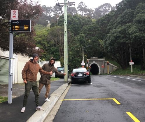
Free Walking Solution- Hataitai to CBD
- Sarah Free
- Would more people walk to work or school from the Eastern suburbs if they didn’t have to use the dark, crowded, loud and smelly Mt Victoria tunnel?Here’s the idea: can WCC and GWRC work together to give walkers a free trip from one side of the Hataitai bus tunnel to the other?Once the bus system is up and running with a bit of spare capacity, think what a boon that could be for walkers.
- Accepted from Sarah Free posts by feedreader
- Tagged as:
- hataitai
- bus-tunnel
- buses
Hataitai Bus Tunnel, Mount Victoria, Wellington, Wellington City, Wellington, 6011, New Zealand (OpenStreetMap)
-
-
-
Targeted consultation has positive results for Broadmeadows, Khandallah and Ngaio bus users
- Greater Wellington Regional Council
- Proposed changes to Broadmeadows and Khandallah bus services have been modified, and now include a full seven days a week bus service for Broadmeadows, after targeted consultation with residents.
- Accepted from GW Feed
- Tagged as:
- khandallah
- ngaio
- consultation
- buses
Broadmeadows, Wellington, Wellington City, Wellington, New Zealand/Aotearoa
-
-
-
Consultation delivers expanded bus service for Churton Park
- Greater Wellington Regional Council
- Two new bus routes - to provide a more convenient, affordable service that meets the needs of rapid growth - are being proposed for Churton Park residents after extensive community consultation.
- Accepted from GW Feed
- Tagged as:
- consultation
- buses
Churton Park, Wellington, Wellington City, Wellington, New Zealand/Aotearoa
-
-
-
Earlier bus now possible for Strathmore service
- Sarah Free
- After contacting Mathew Lear of Greater Wellington with my concerns about the need for an earlier Strathmore service, I received the following email: “Just a heads up, after your feedback we’ve amended the draft timetables and the 6:20am trip from Strathmore now added to the latest draft timetable which provides a connection to Wellington Hospital […]
- Accepted from Sarah Free posts
- Tagged as:
- buses
- strathmore
Strathmore Park, Wellington, Wellington City, Wellington, 6242, New Zealand (OpenStreetMap)
-
-
-
Reactivating a bus stop
- Sustainable Wellington Transport
- Bus stop 7918 was closed during the construction of the Countdown store in Newtown. I don’t remember how long it was down for, but it was a significant length of time. With the store opening today, I’d asked Metlink when the stop would be reopening. I think we were both surprised by the answer: Also today. Encouraged by this, I went down to the stop this morning and caught the next bus coming along. The driver insisted that the stop wasn’t open yet. The paint is down and the sign is up, but the bus stop isn’t really a bus stop. She let us on anyway.
- Accepted from Sustainable Wellington Transport posts
- Tagged as:
- newtown
- buses
John Street, Newtown, Wellington, Wellington Region, 6021, New Zealand
-
-
-
Frequent Airport Flyer
- Sustainable Wellington Transport
- I first noticed the news of the changes to the Airport Flyer in an article that appeared in the DomPost.
- Accepted from Sustainable Wellington Transport posts
- Tagged as:
- buses
- airport
Wellington International Airport, Coutts Street, Rongotai, Wellington, Wellington City, Wellington, 6023, New Zealand (OpenStreetMap)
-
-
-
Airport Flyer - More Arrivals and Departures from January 2013
- Go Wellington
- NZ Bus today announced changes that will further improve their already highly successful Airport Flyer service in Wellington. From 14 January 2013, there will be a significant increase in frequency with the Airport Flyer bus departing Wellington Airport every 10 minutes during peak times to Wellington train station and back instead of the current 15 minutes. In addition to the new 10 minute peak frequency to and from the Airport and Wellington Station, all Airport Flyer buses will travel via Cobham Drive which will further enhance the reliability of this quality service.
- Submitted by tonytw1
- Tagged as:
- buses
- airport
Wellington International Airport, Coutts Street, Rongotai, Wellington, Wellington City, Wellington, 6023, New Zealand (OpenStreetMap)
-
-
-
Mad about traffic lights
- Wellington Scoop
- The pedestrian crossings in Courtenay Place have always worked well without traffic lights, for cars as well as pedestrians. But not, according to bus drivers, for buses.
- Accepted from Wellington Scoop features
- Tagged as:
- buses
Courtenay Place, Mt. Victoria, Wellington, Wellington Region, 6011, New Zealand
-