Search / “15 Reasons Spring Weather Is So Unpredictable”
Matching Newsitems
-
-
Locating Immediate Products For how to make money online for free
- Learn How to Make Money Online for Free – Business and Finance Articles {The Net {is a great|is a superb|is a good|is an excellent} {spot to|destination to|location to|destination for a} {earn income|earn money|generate income|make money} {and to|and also to|also to|and} achieve your fiscal independence. The only problem {is that|is the fact that|is always that|is} there’s […]
- Accepted from Squash Wellington news
- Not tagged
-
-
-
Winter Series Points table after Race 2 (31 July 2021)
- Kapiti Cycling Club
- Here are the points after Race 2: A GRADE Race 2 Points balance Points Round 2 Total Points Name Place Steve Bale 4 20 12 32 Katie Richards 11 17 1 18 Christopher Paul Harris 3 14 14 28 Peter Mora 1 12 20 32 Campbell Jamiesen 10 10 Jack Polley 9 8 5 13 Matthew Cryer 16 7 1 8 Matt Frecklington 10 6 4 10 Luke McDermott 18 5 1 6 Josh Courtis 2 4 17 21 David Finley 6 1 8 9 Daniel Shepherd 5 10 10 Rob Kilvington 6 8 8 Matt Shatland 8 6 6 Paul Rawlinson 12 1 1 Tony Gestro 13 1 1 Mark Hussey 14 1 1 Thomas Berry 15 1 1 Matthew Webber 17 1 1 Elliot Robertson 19 1 1 Callum Kennedy 20 1 1 David Weaver 21 1 1 B GRADE Race 2 Points balance Points Round 2 Total Points Name Place Stephen O'Keefe 1 20 20 40 Paul Rawlinson 17 17 Mark Coburn 3 14 14 28 Oliver Ferry 12 12 Rhys Evans 9 10 5 15 Darren Murdie 11 8 1 9 Mike Dunne 4 7 12 19 Andrew Anson 6 6 Tim Mackey 20 5 1 6 Mike Craine 4 4 Alex Foden 1 1 Leon Goodwin 8 1 6 7 Johan Oelofse 1 1 Gary Clareburt 18 1 1 2 Richard Graham 6 1 8 9 Dwight garton 21 1 1 2 Rob Ryan 10 1 11 Carl Dickeson 15 1 1 2 Andrew Richardson 1 1 Euan Mason 1 1 Yoshi Shinoda 5 1 10 11 JOSHUA TURNBULL 1 1 Matthew Walker 16 1 1 2 Chris Sharot 2 17 17 Alex Foden 7 7 7 Kristine Ford 12 1 1 Tim Lloyd 13 1 1 Nathan Cook 14 1 1 James de Hair 17 1 1 Toshi Yamauchi 19 1 1 C GRADE Race 2 Points balance Points Round 2 Total Points Name Place Ian Riddle 1 20 20 40 Janice Hill 5 17 10 30 John Valentine 14 14 Ian Gordon 12 12 1 13 Ian Cooke 9 10 5 15 Dave Chandler 10 8 4 12 Bruce Edgar 7 7 7 14 Chris McBride 3 6 14 20 John Pratt 14 5 1 6 Greg Overton 4 4 Tony Levaggi 1 1 Oscar Goodwin 2 1 17 18 Adrian Mckenzie 1 1 Alex Glenn 15 1 1 2 Kenzey Compton 1 1 Hugh Swartbooi 17 1 1 2 Wayne John Fage 18 1 1 2 Jo Neeson 4 12 12 Mike Harding 6 8 8 Steve Nagy 8 6 6 Millie Donald 11 1 1 Phil Cocker 13 1 1 Ian Fraser 16 1 1 D GRADE Race 2 Points balance Points Round 2 Total Points Name Place Ian Fraser 20 Jo Neeson 17 Robert Scotcher 1 14 20 34 John Rowlinson 7 12 7 19 Serena Scotcher 3 10 14 24 Dave Downer 4 8 12 20 Reg Robinson 7 Darryn Cooke 2 17 17 Jamie Carey 5 10 10 Mark Neeson 6 8 8 Frances de Hair 8 6 6 Liz Gasson DNF 1 1 SOCIAL CIRCUIT Race 2 Points balance Points Round 2 Total Points Name Place Kassidy compton 20 20 Eve Rongo 17 17 Louise Kātene 14 14 Des Batten 1 20 20 Catherine Reid 2 17 17 Andrew Lowe 3 14 14 Euan Mason 4 12 12
- Accepted from Kapiti Cycling Club results 2020 by feedreader
- Automatically tagged as:
- kapiti
- cycling
-
-
-
Election season climate questions
- Low Carbon Kapiti
- Election season is upon us and it is more important than ever that climate action is on the agenda.
- Accepted from Low Carbon Kapiti feed by feedreader
- Automatically tagged as:
- conservation
- kapiti
-
-
-
It isn’t easy being Green
- WCC Watch
- The campaign is well and truly underway with the Aro Valley meeting tonight – but the question is, where is Celia Wade-Brown? Where is her campaign? I spent the weekend […]
- Accepted from WCC Watch feed
- Tagged as:
- aro-valley
Aro Valley, Wellington, Wellington City, Wellington, New Zealand (OpenStreetMap)
-
-
-
Projected Image 2024
- Wellington Photographic Society
- This is the WPS Annual Competition for Projected Images which is open to all members of the society and is […]
- Accepted from WPS posts by feedreader
- Automatically tagged as:
- photography
- community-groups
- wcn-hosted
-
-
-
Principal’s Message – Mid-Term, 2019
- Wellington High School
- Message from the Principal “It was the best of times, it was the worst of times, it was the age of wisdom, it was the age of foolishness, it was the epoch of belief, it was the epoch of incredulity, it was the season of Light, it was the season of Darkness, it was the spring of hope, it was the winter of despair, we had everything before us, we had nothing before us, we were all going direct to Heaven, we were all going direct the other way …” I’m sure many of you will recognise these beautiful words from “A Tale of Two Cities” by Charles Dickens and you will probably know why I am starting my message with this quote. We are in uncertain times, there is hope and there is despair and the despair seems to be outweighing the hope at the moment. Unfortunately, negotiations with the government are not going well and disruption is occurring in our schools. This is not what any of us want but these are the times we are living in. The current government has inherited 9 years of neglect and they obviously cannot rectify this immediately but their intransigence on various aspects of the negotiations is reprehensible. Education is a fundamental right and governments should be nurturing and cultivating the best teaching workforce so that we can have the best education system. The government should be leading the conversations about the best ways to do this but they are not. The key ingredient here, as I’m sure you know, are the teachers who are in front of our young people every day. We, as a society, have to decide whether we value those people or not. We have to decide whether we want the best people caring, supporting and inspiring our young people or not. Thank you for your support during these times and we will need it in the weeks ahead. I am sad to announce that Eric Tan has left us today to return to his home country of Singapore. Eric worked with us for 3 years in the Science department and made quite an impression with his calm, relational manner, his thorough planning and the cleanest Science labs you will ever see! We have already welcomed Dylan Weatherley-Libeau into the Science department this week as Eric’s replacement and we will also be welcoming Shaun Tavernor next week as a new Deputy Principal, and a Science teacher. Staffing changes inevitably cause more disruption and I thank the students for their patience in these times. You should have received information and brief biographies of persons standing for election in the upcoming Board of Trustees elections. Please read these carefully and make sure your voice is a part of this process by voting by 12.00pm on 7 June. It is also important to recognise the service of outgoing members, particularly Deanne Daysh who has served on our board for over 6 years with the last three spent as board chair. Deanne has donated a huge amount of her time to the school and I am forever in debt for her inspirational leadership and support in this forum. We have recently renamed our special needs unit from base 1 to He Kākano. He Kākano means ‘seed’ and conveys growth, development and expansion. Even before a seed is planted or nourished, it has inherent promise – the capability to take root, develop, grow and blossom. He Kākano reminds us of the opportunity we have in schools to make new beginnings, to plant, to nurture, to cherish, to realise potential, to grow and enhance that which is. He Kākano is a symbol of productivity and the promise of success through learning and achievement. Finally, this is the time of year when we market ourselves to our community. We have had feeder school visits and we are about to run our annual Open evening on Monday 10 June. We always look forward to this opportunity to showcase the work that we do at our great school. My speech to the feeder school students was about opportunity and the words above which He Kākano embodies, explain this perfectly: opportunity “to make new beginnings, to plant, to nurture, to cherish, to realise potential, to grow and enhance that which is”. Ngā mihi nui Dominic Killalea
- Accepted from WHS news by feedreader
- Automatically tagged as:
- secondary
Wellington High School, Taranaki Street, Mount Cook, Wellington, Wellington City, Wellington, 6011, New Zealand (OpenStreetMap)
-
-
-
Weekly E-news for 22 August 2025
- St Andrews on the Terrace Presbyterian Church
- E-NEWS 22ND AUGUST 2025 Welcome to Tongan language week, Malo lelei is hello in Tongan, fefeake is how are you? Saipe is I am well. Ofa atu is with love. […]
- Accepted from St Andrews feed by feedreader
- Automatically tagged as:
- crossways
- religious-groups
St Andrew's on the Terrace, 30, The Terrace, Paekākā, Wellington Central, Wellington, Wellington City, Wellington, 6011, New Zealand (OpenStreetMap)
-
-
-
Protected: Bus Trip – Upper Hutt
- Wellington Runners & Walkers (WRW)
- There is no excerpt because this is a protected post.
- Accepted from Wellington Runners & Walkers (WRW) feed by feedreader
- Tagged as:
- upper-hutt
Upper Hutt, Upper Hutt City, Wellington, 5218, New Zealand (OpenStreetMap)
-
-
-
Protected: WRW 2024 Financial Report
- Wellington Runners & Walkers (WRW)
- There is no excerpt because this is a protected post.
- Accepted from Wellington Runners & Walkers (WRW) feed by feedreader
- Automatically tagged as:
- athletics
- wcn-hosted
-
-
-
Protected: Pre-order your WRW Tops
- Wellington Runners & Walkers (WRW)
- There is no excerpt because this is a protected post.
- Accepted from Wellington Runners & Walkers (WRW) feed by feedreader
- Automatically tagged as:
- athletics
- wcn-hosted
-
-
-
SEPTEMBER
- Slow Boat Records
- Howdy, y’all! Well, without wishing to jinx it, it was a pretty mild Winter, all things considered, and Spring, it was seem, has, um, sprung?! HEAPS of new stuff instore – tee shirts, posters, DVDs, NOT TO MENTION some fantastic new LPs and CDs from (here we go)… Taylor Swift (a real return to form!), Lloyd Cole, Thom Yorke, Lizzo, Ride, Peter Perrett, Purple Pilgrims, PP Arnold, Lana Del Rey… we are also digging the latest Ace Records compilation of cheery 90’s hip hop entitled “The Daisy Age”, featuring De La Soul, Brand Nubian, Queen Latifah, Del Tha Funkee Homosapien and heaps more – recommended!! We have also just taken delivery of EIGHT(!!!) boxes of terrific new LPs from the US, featuring many deleted and hard-to-find titles from a-Ha, Roy Ayers, The Beach Boys, Nine Inch Nails, King Crimson, Fugazi, The Proclaimers, Rammstein, , REM, Parquet Courts, Public Enemy, Lou Reed, Elton John, The Jesus & Mary Chain… I could go on, but perhaps best if you come and take a look for yourself – will have them out by the weekend! Also out this Friday – the brand spankin’ new release from one of the stars of last year’s Slow Boat Record Store Day event – Mermaidens, with their new album “Look Me In The Eye” – CD and lovely coloured vinyl… Also, a reminder that we place a US import order every 2-3 weeks, and there are a huge array of titles available – be warned that our falling exchange rate against the US has rendered some stuff on the pricy side… and that it will be Christmas before you/ we know it – have a think about it now and get real organised ahead of Festivus?!? We are here to help you look as kindly and generous as possible… Wishing everybody a happy and prosperous Spring – new beginnings, and all that – catch you all soon!! XX The Slow Boat Crew XX
- Accepted from Slowboat posts by feedreader
- Automatically tagged as:
- cuba-street
- music
- retail
Slow Boat Records, Cuba Street, Te Aro, Wellington, Wellington City, Wellington, 6040, New Zealand (OpenStreetMap)
-
-
-
Lepper Family
- Friends of Karori Cemetery
- In the earliest Anglican area, there is a large solid column with an urn on top, all of which is wooden. Standing 8ft/2.44 metres tall it is an exact replica of a design more usually made in stone, and from a distance there is nothing to suggest it is wooden. The monument is carved from […]
- Accepted from Friends of Karori Cemetery stories by tonytw1
- Tagged as:
- community-groups
- karori
- local-history
Karori Cemetery, Northland, Wellington, Wellington City, Wellington, New Zealand (OpenStreetMap)
-
-
-
Just unbussable? Bus networks and Porirua
- Talk Wellington
- Train patronage is rising, but Porirua is driving more and more.
- Accepted from Talk Wellington posts by feedreader
- Tagged as:
- porirua
Porirua, Wellington Region, New Zealand (OpenStreetMap)
-
-
-
School Notices - 7 December 2020
- Amesbury Drive School Blog
- This is what is happening for the last week of 2020 .
- Accepted from Amesbury Drive School feed by feedreader
- Automatically tagged as:
- johnsonville
-
-
-
Holding back the water
- Wellington Scoop
- Wellington is facing serious flooding risks. Flood-planning is becoming necessary.
- Accepted from Wellington Scoop features by feedreader
- Automatically tagged as:
- media
-
-
-
Hard work keeps rail improvements on track
- Metlink
- Metlink is showing its gratitude to Kiwirail and its passengers for their patience, while work went ahead on the Wellington rail network over Summer. Daran Ponter, Greater Wellington Council Chair, said Kiwirail should be proud of its efforts to improve the network’s safety, performance, and sustainability. “I’d like to thank those who worked so diligently on the network during a time when the majority of us were enjoying a break from work,” Ponter said. “I hope they take satisfaction from knowing that commuters will reap the benefits of their hard work now and in the future.” On Boxing Day, work started at Plimmerton Station to build an additional platform, realign the tracks, and enhance safety measures at Steyne and Pascoe Avenue level crossings.
- Accepted from Metlink news by feedreader
- Tagged as:
- trains
-
-
-
Pauatahanui Public Burial Ground Trust Deed
- Pauatahanui Residents Association
- The renovation of Pataka Museum’s storage area in 2017 brought to light two documents that are probably the oldest existing paper records of early Porirua. In 1856 the village of Pahautanui (now called Pauatahanui) was the only settlement in the Porirua area. Thomas Hollis Stace, who had arrived with his family from Tasmania in 1853, bought a piece of land on the southern edge of the village. He saw that the village lacked a school, church and cemetery; so he donated an acre of his land to help fill these gaps. The details of this generous gift were set down on two sheets of parchment on 6 December 1856, and it is this 161-year-old Trust Deed that has emerged from the Pataka storeroom.
- Submitted by tonytw1
- Tagged as:
- local-history
-
-
-
A trip to the Empire above Pae Kawakawa
- Wellington Scoop
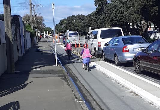
- Last Sunday my family found ourselves unexpectedly home early from a class noho marae. So we ended up doing a cycling trip to the Empire Cinema in Island Bay to see Encanto Reo Māori. Because the cycleway connection in Berhampore is only half built, we took a short-cut from our home in Berhampore to get to the Parade. The kids were very keen, as they always are, to get their “bikes on the road.” These streets from Adelaide Road in Berhampore to the Parade in Island Bay, Tapu te Ranga, are another group of city streets built above waterways. The Pae Kawakawa stream starts near Macalister Park and runs along these roads with feeder streams in Mornington and Southgate as well.
- Accepted from Wellington Scoop features by feedreader
- Tagged as:
- cycle-lanes
- cycling
- island-bay
Island Bay, Wellington, Wellington City, Wellington, New Zealand/Aotearoa (OpenStreetMap)
-
-
-
2008 TAWAs - the winners!
- The Wellingtonista
- We all had a completely brilliant time on Thursday night at the TAWAs! It was great to see so many of y'all along there, along with the awesome nominees and a few celebrity guests (not that Wellington has any actual celebrities, but, you know...) Thanks to our fabulous sponsors who gave us swag and prizes And thanks also to Wellington Central MP Grant Robertson for presenting the Wellingtonian of
- Tagged as:
- tawa
Tawa, Wellington, New Zealand (OpenStreetMap)
-
-
-
P2 Men Vs Northern United 18/08/07 Lost 2 - 0
- Upper Hutt Hockey Club
- t was a hard fought game which unfortunately did not bring about the win upper hutt so desperately wanted. A generally well contested game was marred by a brain explosion by the Northern Goalie who pushed over an upper hutt player well after the play of the ball. Too few opportunities were created on attack and despite having more PC's than in previous games the execution was terrible.
- Automatically tagged as:
- hutt-valley
- hockey
-
-
-

No Rovers Ticket Issues
- Zephyr Rovers FC
- Zephyr Rovers Chairman George Nash confirmed today that Zephyr Rovers were not suffering the same ticketing issues as the Wellington Phoenix. "We see they've had trouble getting people in the gates and touch wood it isn't a problem we've had so far" said Nash "in fact we're prepared to take on any disgruntled Phoenix season ticket holders and they can watch out games for the rest of the season for free".
- Tagged as:
- soccer
-
-
-
The Wellingtonista guide to drinking for free
- The Wellingtonista
- Now, don't get me wrong: we Wellingtonistas are not usually parsimonious when it comes to paying for drinks. On the other hand, we're a canny and logical bunch, and it only takes about 10 free glasses of house wine to save up enough for a Mega Mai Tai, so in the long run it pays to seek out gratis grog. Let's start with the obvious: gallery openings and launches.
- Automatically tagged as:
- blogs
- featured
-
-
-
Fat Freddy's Drop
- The Wellingtonista
- So, Simon Sweetman's live review of Fat Freddy's Drop (he really, really didn't like them) seems to have touched a nerve amongst some in the Wellington music scene. A few (actually, quite a lot) have come out in support of Sweetman - says Josef... the perfect music for the iPod generation who wouldn't know good music if it bit them in the ass. And Hugh... Thank goodness someone has seen the elepha
- Automatically tagged as:
- blogs
- featured
-
-
-
Easter Services
- Karori Anglican Churches
- 5 April—Palm Sunday Usual Services but a donkey at the 10.30 am service. 24/7 Prayer Prayer Vigil will take place again this year. Clipboards with times will be circulated so you can book your slots. 9 April—Maundy Thursday 7.00 pm Traditional foot washing service and institution of Lord’s Supper. 10 April—Good Friday 10.00 am Family friendly service. 12.00—3.00 pm Three hour Stations of
- Automatically tagged as:
- karori
- wcn-hosted
- anglican
-
-
-

BNU Reserves vs North Wellington 23/5/09
- Brooklyn Northern United AFC
- BNU reserves travelled to Alex Moore Park in Johnsonville on Saturday for the season's return fixture against North Wellington. We'd drawn 1-1 at Wakefield in the first game of the season and we were determined to do our best to better the result. We arrived for the 2:30 kickoff amidst a not so pleasant southerly storm, with BNU's own weatherman Rob Kerr predicting conditions to worsen. We started
- Tagged as:
- johnsonville
- soccer
-
-
-
Premier v Kapiti Coast - 01/06/09 - D 1-1
- Island Bay United AFC
- On the Queens Birthday, while she was sipping high tea and giggling at a re-run of Coronation Street, we were freezing our bits off chasing a few bits of stitched together leather around a paddock.Wakefield Number 1 looked like it had been used by the NZ Army for Tank Wars, so the match was transfered all the way over to Brooklyn's home ground, Wakefield Number 2. Ahhhhhh, much better............;
- Tagged as:
- brooklyn
- kapiti
Brooklyn, Wellington, New Zealand (OpenStreetMap)
-
-
-
Premier v Lower Hutt - 13/06/09 - W 3-2
- Island Bay United AFC
- Firstly, on behalf of the Premier Team and it's Management, we express our sincerest and deepest condolences to Jamie Milne and his family, as they farewell his father.Bruce lost his battle with Cancer early on Saturday morning.About the game:What can I say? A week after receiving a mauling at the hands of Tawa, and we were a completely different team. Sure, we still conceded our standard early so
- Tagged as:
- tawa
Tawa, Wellington, New Zealand (OpenStreetMap)
-
-
-
Weekly Report 25th October
- Wellington Runners & Walkers (WRW)
- Welcome back Rob, hope you had a great break. We get Rob back only to lose Betty – it’s all go! Betty goes in for a hip operation this week so will be out of action for at least 4 weeks (it’s meant to be 6, but you can’t hold a good woman down for that long!). Good luck with the op Betty, and enjoy your rest while you can.
- Automatically tagged as:
- athletics
- wcn-hosted
-
-
-
Davis Food Market: an investigation
- The Wellingtonista
- We noticed Davis Food Mart pop up on the corner of Taranaki & Karo Drive a little before Xmas, so we decided it was time to check it out to see if Mt Cook now has a proper supermarket to call its own. It doesn't. But we did find some very interesting things anyway, and you can read more about them after the break. read more
- Automatically tagged as:
- blogs
- featured
-

- 1
- 2
- 3
- 4
- 5
- 6
- 7
- 8
- 9
- 10
- 11
- 12
- 13
- 14
- 15
- 16
- 17
- 18
- 19
- 20
- 21
- 22
- 23
- 24
- 25
- 26
- 27
- 28
- 29
- 30
- 31
- 32
- 33
- 34
- 35
- 36
- 37
- 38
- 39
- 40
- 41
- 42
- 43
- 44
- 45
- 46
- 47
- 48
- 49
- 50
- 51
- 52
- 53
- 54
- 55
- 56
- 57
- 58
- 59
- 60
- 61
- 62
- 63
- 64
- 65
- 66
- 67
- 68
- 69
- 70
- 71
- 72
- 73
- 74
- 75
- 76
- 77
- 78
- 79
- 80
- 81
- 82
- 83
- 84
- 85
- 86
- 87
- 88
- 89
- 90
- 91
- 92
- 93
- 94
- 95
- 96
- 97
- 98
- 99
- 100
- 101
- 102
- 103
- 104
- 105
- 106
- 107
- 108
- 109
- 110
- 111
- 112
- 113
- 114
- 115
- 116
- 117
- 118
- 119
- 120
- 121
- 122
- 123
- 124
- 125
- 126
- 127
- 128
- 129
- 130
- 131
- 132
- 133
- 134
- 135
- 136
- 137
- 138
- 139
- 140
- 141
- 142
- 143
- 144
- 145
- 146
- 147
- 148
- 149
- 150
- 151
- 152
- 153
- 154
- 155
- 156
- 157
- 158
- 159
- 160
- 161
- 162
- 163
- 164
- 165
- 166
- 167
- 168
- 169
- 170
- 171
- 172
- 173
- 174
- 175
- 176
- 177
- 178
- 179
- 180
- 181
- 182
- 183
- 184
- 185
- 186
- 187
- 188
- 189
- 190
- 191
- 192
- 193
- 194
- 195
- 196
- 197
- 198
- 199
- 200
- 201
- 202
- 203
- 204
- 205
- 206
- 207
- 208
- 209
- 210
- 211
- 212
- 213
- 214
- 215
- 216
- 217
- 218
- 219
- 220
- 221
- 222
- 223
- 224
- 225
- 226
- 227
- 228
- 229
- 230
- 231
- 232
- 233
- 234
- 235
- 236
- 237
- 238
- 239
- 240
- 241
- 242
- 243
- 244
- 245
- 246
- 247
- 248
- 249
- 250
- 251
- 252
- 253
- 254
- 255
- 256
- 257
- 258
- 259
- 260
- 261
- 262
- 263
- 264
- 265
- 266
- 267
- 268
- 269
- 270
- 271
- 272
- 273
- 274
- 275
- 276
- 277
- 278
- 279
- 280
- 281
- 282
- 283
- 284
- 285
- 286
- 287
- 288
- 289
- 290
- 291
- 292
- 293
- 294
- 295
- 296
- 297
- 298
- 299
- 300
- 301
- 302
- 303
- 304
- 305
- 306
- 307
- 308
- 309
- 310
- 311
- 312
- 313
- 314
- 315
- 316
- 317
- 318
- 319
- 320
- 321
- 322
- 323
- 324
- 325
- 326
- 327
- 328
- 329
- 330
- 331
- 332
- 333
- 334
3631 - 3660 of 10000
Matching websites
-
-
The Hutt Valley
- The Hutt Valley is home to unique visitor experiences and accessible outdoor recreation just 15 minutes from downtown Wellington City.
- Tagged as:
- tourism
- hutt-valley
-
-
-
WCC Transport Projects
- We’re investing in our transport network Find out about our planned transport projects and share your views so Wellington's transport network is safer and more convenient for everyone.
- Submitted by tonytw1
- Tagged as:
- consultation
- transport
- wellington-city-council
-
-
-
Young and hungry arts trust
- The Young and Hungry Arts Trust is a charitable organisation that was founded in 1994 in association with BATS Theatre. Young and Hungry arose out of a need to provide young people, aged 15-25 years, with opportunities to gain hands-on theatre experience within a professional structure.
- Submitted by tonytw1
- Tagged as:
- theatre
-
-
-
Flying Filing Squad
- We love filing (so you don't have to)
- Tagged as:
- business
-
-
-
Creative Mouse Design
- A design company with over 15 years experience in the field. Our expertise includes brand identity and development, web design, exhibitions, photography and much, much more.
- Tagged as:
- design
-
-
-
Young and Hungry
- Young & Hungry started life in 1994 at Bats theatre as a series of one act plays designed to give young people, aged between 15-25 years, the opportunity to partake in a professional theatre environment under the direction of professional theatre practitioners. Since then it has significantly grown and is now run by the Young and Hungry Arts Trust.
- Tagged as:
- performing-arts
-
-
-
Paul Michaels Wellington Wedding Photography
- Award winning photographer, inspired wedding images, stunning portrait and engagement pictures taken with fun and style. Your wedding is one of the most important days of your life, capture all the events in pictures that make your wedding so special.
- Tagged as:
- photography
-
-
-
Evans Bay Intermediate
- Evans Bay Intermediate is the only specialist provider of Education for Years 7 and 8 in the Eastern Suburbs. The school was opened in 1964 and has a roll of approximately 450 students. It caters for students in the Seatoun, Miramar, Kilbirnie, Lyall Bay areas with an ethnic mix of approximately 60% European, 12.5% Maori, 15% Asian, 9.5% Pacific Island.
- Tagged as:
- primary
- kilbirnie
-
-
-
Wellington Softball Association Inc.
- The Wellington Softball Association incorporates 15 clubs covering 79 senior and 91 junior teams within the following area Wellington City Porirua City and the Kapiti Coast District south of the Otaki River.
- Tagged as:
- softball
-
-
-
The Jackson Street Programme
- Jackson Street is a heritage icon, combining an eclectic mix of old buildings with funky cafés and boutique shopping. The retail strip boasts a huge variety of specialty shops, cafés, bars and restaurants that supply a wide range of ethnic foods, great coffee and goods not available anywhere else. The majority of shops are run by the owners, so the service is second to none!
- Tagged as:
- retail
- petone
-
-
-
Boulcott Street Bistro
- Our doors opened in 1991, since then we have been serving Wellingtonians innovative, modern food as well as some classics such as Lamb Shanks, Fillet Bearnaise and Creme Brulee. Reservations are accepted for lunch only. Dinner is casual dining so just come along and you will feel more than welcome.
- Tagged as:
- restaurants-and-bars
-
-
-
Learn English NZ
- Learn English NZ - Learn to speak and write English with homestay English tuition. Intensive one-to-one teaching for 10-15 hours per week. Stay in the seaside home of native English speaking, fully qualified teachers and combine learning and sightseeing
- Tagged as:
- education
-
-
-
Green Parrot Cafe
- My parents used to eat at the Green Parrot. So did their parents. And God knows my kids will probably eat there too.
- Tagged as:
- cafes
-
-
-
Newtown Festival
- This 10 day extravaganza will celebrate the diversity and vibrancy of Newtown, where so many cultures experience a real sense of place, belonging and community.
- Tagged as:
- newtown
- events
- wcn-hosted
-
-
-
The life and times of James Walter Chapman-Taylor
- ‘The life and times of James Walter Chapman-Taylor’ enables us to enter into the life and times of a man, a family, a society, and ways of thinking and acting different to, yet not so distant from, our own. We enter the world of an architect, who is also an artist; builder, craftsman; a theosophist, an astrologer, a photographer, a furniture maker.
- Tagged as:
- heritage-buildings
- art
-
-
-
East by West Ferry
- Experience the best of Wellington with a cruise out on the city's harbour ferry service. Up to 15 return scheduled sailings daily between Queens Wharf/Matiu Somes Island/Days Bay. Additionally in the weekends our new round Harbour Explorer Tours include stops at Petone, Seatoun, Days Bay, Matiu Somes Island & Queens Wharf.
- Tagged as:
- ferry
-
-
-
Verb Wellington
- Welcome to the Festival of Verb Wellington. We are so excited for all that we have in store Join us to celebrate people, stories, books, writers, readers and conversation!
- Submitted by tonytw1
- Tagged as:
- books
- community-groups
-
-
-
Sarah Free
- I started this site as a forum to discuss all sorts of things related to urban Wellington living, and so it will continue. I hope at least some people are finding it interesting and/or useful!
- Submitted by tonytw1
- Tagged as:
- people
-
-
-
Hutt Valley Concert Orchestra
- We are a community orchestra, based in the Hutt Valley of New Zealand. The 40 or so players come from a wide variety of occupations, but are united in their love of playing music in a full orchestra.
- Tagged as:
- hutt-valley
- music
- wcn-hosted
-
-
-
Greater Wellington Regional Council Have Your Say
- Have Your Say has been set up so that you, your family, friends and work mates can help shape the future direction of our region, and assist and guide us in making important decisions that affect our region.
- Submitted by tonytw1
- Tagged as:
- consultation
- regional-council
-
-
-
Wellington Volunteer Coastguard Inc
- The defining moment that so tragically expressed the need for a Life-Boat Service based in Wellington was the sinking of the 'Wahine' in Wellington harbour, 1968. This need was eventually met by the founding of this organisat
- Tagged as:
- emergency-services
- boating
-
-
-
Lower Hutt Amateur Athletic Club
- The Lower Hutt Amateur Athletic Club (LHAAC) caters for children aged 7-15 years. The 2006-07 season runs from 25th October to 15th March. Club nights offer a mixture of competition and coaching to enable children to gain the necessary skills to participate in a variety of running, jumping and throwing events. The club meets at the Hutt Recreation Ground on Wednesday nights from 6.00pm-7.30pm.
- Tagged as:
- hutt-valley
- athletics
-
-
-
A City for People
- Decades of inaction have meant house prices are out of control, while old rental properties rot out from underneath us. A whole generation of people are at risk of being forced out from the central city into new suburbs sprawling north, spending hours every day in traffic jams. We believe the Spatial Plan will allow Wellington to plan for the future so that new generations of Wellingtonians can share the city we love, and have a chance to live in a home that is affordable, accessible, healthy and warm.
- Submitted by tonytw1
- Tagged as:
- draft-spatial-plan
- housing
- lobby-groups
-
-
-
Yellow Fever
- Supporters of Wellington Phoenix FC. We dig our football. We think its brilliant Wellington has the A-League franchise. We know Wellington has a great football community and we know the city will get behind the team. So will we - and we'll have a bit of a lark along the way.
- Tagged as:
- soccer
-
-
-
Masala Restaurant
- Masala Indian Restaurant welcomes you to join us in central Wellington for the ultimate Indian dining experience.Our comfortable lounge style setting and warm atmosphere will ensure you a great night out on the Courtney Place Strip. We have a large restaurant so we can easily cater for both big group bookings or dinner for two.
- Tagged as:
- restaurants
-
-
-
Manawa Karioi Ecological Restoration Project
- Manawa Karioi Ecological Restoration Project is one of Wellington's oldest reforestation projects and is on land that is part of Tapu Te Ranga Marae in Island Bay.
- Submitted by tonytw1
- Tagged as:
- conservation
- island-bay
Te Ahi Ka - Loop Track, Island Bay, Wellington, Wellington City, Wellington, 6023, New Zealand (OpenStreetMap)
-
-
-
The Street City Church
- We're a group of everyday people who are trying to become the kind of church described in the Bible, where teaching is relevant, worship is real and lived-out everyday, friendships are honest, prayer is constant and compassionate care is given to those in need.
- Tagged as:
- religious-groups
-
-
-
Wakefield Hospital
- Wakefield Hospital is the largest private hospital in the Wellington region. It is located in the suburb of Newtown and along with Bowen Hospital is owned and operated by parent company Wakefield Health Ltd.
- Tagged as:
- hospital
- newtown
-
-
-
Glenside - the halfway
- Glenside is a suburb located between Wellington and Porirua, centrally located at the southern end of New Zealand's North Island. It is mainly rural zoned and is between the neighbouring communities of Johnsonville and Tawa on the old Porirua Road. Hills, streams and rural landscape characterise the area. The resident population is 336
- Tagged as:
- wcn-hosted
- porirua
- johnsonville
- community-groups
- tawa
-
-
-
Makara Hall and St Patricks Church
- Originally built in 1873 by the Catholic diocese, St Patricks is a non-denominational, community owned church. Situated in the farming and lifestyle area of Makara, St Patricks is twenty minutes drive from the centre of Wellington. The Church is listed with the Historic Places Trust and is lovingly maintained by local volunteers.
- Submitted by tonytw1
- Tagged as:
- heritage-buildings
- makara
- religious-groups
-
