Porirua / June 2020
July 2020 | May 2020-
-
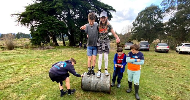
Forest Lakes Camp 2020
- Ngati toa Sea Scouts
- Monkeying Around
- Accepted from Ngatitoa Sea Scouts feed by feedreader
- Automatically tagged as:
- scouts
- porirua
- wcn-hosted
- boating
- paremata
Ngati Toa Scout Group, Parade Ground, Mana, Paremata, Porirua, Porirua City, Wellington, New Zealand (OpenStreetMap)
-
-
-
Plimmerton Farm: getting greenfields right
- Talk Wellington
- If we’re hellbent on doing more residential development in greenfields, what does “decent” look like in Plimmerton, hilly land near an existing suburb – like most of our region’s greenfields? This post is basically a guide for anyone who cares about Plimmerton, good urban development, or healthy wetlands, streams and coast, but is time-poor and can’t face going through the truckloads of documents they’ve stuck up without any specific meta-guidance (some FAQ are here). Hopefully this will help you pop in a submission! PCC’s “information” pages they suggest you use for submitting. Every one of these is a large PDF document, 90% written in technical language… aargh! The background: what where and how For those who don’t know, Plimmerton Farm’s a big proposed subdivision of hilly farmland draining into the significant Taupō Wetland and to Plimmerton Beach, just over the train line and highway from Plimmerton village (original Ngāti Toa name: Taupō). It’s going through a Streamlined Planning Process, a pre-COVID government scheme for accelerating development. The key step is the requisite change of the land’s zoning in the Porirua District Plan (“rural” zone to “residential” and other “urban” zones) that sets out what kind of stuff can then be built, where. It’s mostly streamlined because there’s just one shot for the public to have input on the plan change. One shot. Why submit? I was born and raised in Plimmerton, live here now, and intend to for the rest of my days. I’d love to see it grow, well. I would love Plimmerton to get more wallets, more hearts and minds, more faces (more diverse ones too!). But not with more traffic, and pointless damage to our environment. Right now, the proposal has some serious flaws which need sorting. I say Sorting because the changes won’t make it crazy innovative, just good enough for a development in the spot it is, being kicked off in 2020. Time matters too: there’a a bunch of good things happening imminently (and some bad Porirua trends that need to be reversed). I cover these in Get it right, below. It’s worth submitting because given the situation, a 1990s-grade development just won’t cut it. So what about Plimmerton Farm needs to change? It boils down to two themes: dial down the driveability and dial up the liveabilitymake Local the logical and easy choice for daily needs I’ll outline what needs to change in each. NOTE: There’s a third – don’t stuff the wetlands and streams. This is really important as Taupō Wetland is regionally significant, and all our streams and harbours have suffered from frankly shameful mismanagement of sediment from earthworks-heavy subdivisions like Aotea and Duck Creek, and from the earthworks-a-rama of Transmission Gully. Friends of Taupo Swamp have an excellent submission guide for you – add in some of their suggested bits to your submission. I: Dial down the driveability, dial up the liveability There aren’t many truly black-and-white things in life, but there’s one for towns: If a street is nice to drive in, it’ll be a crappy place to do anything else in (walk / eat / hang out / have a conversation / play / scoot or cycle / shop / have a pint). If it’s nice to do anything else in, it’ll be a crappy place to drive in. Mostly this is because of the nature of the automobile: big solid things that smash into our soft bodies if someone makes a mistake (75% odds of death if that’s at 50km/hour, 10% odds of death if at 30km/hour) big objects that need lots of space for manoeuvering and especially parking – which offstreet can be crazy expensive and push up the cost of a home, and onstreet hoover up valuable public space. big solid things driven by us real humans (for a while at least) who respond to the environment but also get distracted, and generally aren’t good at wielding these big solid things safely. The transport setup proposed for Plimmerton Farm makes for a much too driveable and poorly liveable place. 1. Narrow down all the roads. The current proposal’s roading setup has roads and streets that are too big, and there’s too much of them. Right sized roads for a liveable community The cross-sections for the roads include on-street parking and really wide lane widths. This is really gobsmacking for a consortium that talked a big talk about good practice. For all the reasons that Low Traffic Neighbourhoods are good, this is bad. (And it’s especially nuts when you realise that the excessively wide “arterial” roads (11 metres!) will need earthworked platforms built for them where they’re drawn running up the sharp ridges and across the tops of gullies. Expensive, damaging for the environment, and … what were they thinking?) So recommended changes: NARROW DOWN THE ROADS. Seriously. Design all the living-area streets and roads, and the centre, to be self-explaining for an operating traffic speed of 30km or less – that’s the speed where mistakes are rarely fatal. What does that look like? The designers will know and if they don’t they should be fired. Narrower crossing distances; chicanes (great way to incorporate green infrastructure and trees and seating!); narrowed sight-lines (trees! sculpture!) so no-one driving feels inclined to zoom. Reduced trafficked lanes (rori iti on the larger roads!), with properly wide and friendly footpaths. Threshold treatments, humps, modal filters, all the things we know very well are the natural ways to slow us down when driving, and make streets nicer for people. The beauty of all this “restriction” on driving is how much it frees us up for making everything else appealing. Streets become hospitable for kids to walk, scoot, bike to school safely, using the road not the footpath. Older people and those with impairments can walk and wheelchair safely. Teens coming home from town of an evening can scoot or bike home, safely. Popping down to the shops or for a coffee or to the train becomes a pleasure to do on foot, or on a scooter or bike. And you’re moving in a legitimate way – seeing and being seen, not stuck off in the bush on a “recreational” track like what they’ve described. The ordinary streets and roads are walkable, bikeable, scootable, mobility-scootable, and perfectly driveable, equally safe and useable in all weathers and anytime of day or night. Used to be a big, fast road. Now, kids bike to school and old people can chill out on it. (Mark Kerrison) (And in case you’re worried about firetrucks / rubbish trucks / buses, recall that on even Wellington City’s far more winding, narrower hilly streets everyone gets their rubbish collected and fires fought just fine. On public transport, smaller buses, like those that community transport operators use, are the way of the future for less densely-populated areas like this). Don’t build the through and loop roads. You don’t need signs like this when the only people who bother to drive in are those who live there, or who are visiting friends, because you just have to drive out again the way you came. When it’s the place you live, you’re invested in not being a dick far more than if you’re just out for a drive – or worse, out for a bit of a boyrace hoon on a massive loop route through a whole place. So just don’t build those big connector roads that enable people to drive easily from one residential area to the next, especially the ones up in the hilltops (section C) that just say “come for a hoon!” Instead, connect the living spaces heavily with bikeable, walkable, scootable, disability-friendly streets and lanes, and as much as possible, only one way in and out for cars from each living area. II: Make local logical and easy Plimmerton is a true village, with a great little centre (including a train station!) but Plimmerton Farm is ultimately a damn big area. The way to go is to enable people to get the basics of life – like school, groceries, a coffee – with a little local trip on foot, bike or scooter – it’s more of a bother to get in the car. Right now though, it needs two changes: 1. Provide for a second centre “Bumping into” spaces are known to be crucial to a feeling of neighbourhood, and in the (initial) absence of third places (worship places, community hall, sports club, cafe/pub, a supermarket is a vital social centre. Yet the north end of Plimmerton Farm is currently a deadzone for anything except residential. What things will probably look like under current layout. Like in Edwards Scissorhands without the interest of a castle. There’s no provision for a place to do your household groceries, so people will drive to Mana New World – more car trips – and less opportunity to bump into people who live nearby. (There’ll be no school in Plimmerton Farm for a while, because Ministry of Education isn’t allowed by the Education Act to build a school somewhere until there’s a certain population density of kids to fill it. A shitty Catch-22 for developments which is hopefully going to be fixed … sometime. Just another reason to make walking, biking and scooting really kid-friendly, as extra dropoff traffic for kids going to St Theresa’s, Plimmerton School, Paremata and Pukerua Bay schools will be a nightmare.) So they should provide for an additional centre in the north, including a groceries place of some kind. 2. Intensify within walking distance of Plimmerton proper. We should intensify properly, with lots of medium and even some high density (6 storeys of nicely laid-out density done well!) in the area that’s within a 5-minute walk of Plimmerton Village. The more people can live and work with access to all its many amenities, and its rail station (10 min to Porirua, 30 min to Wellington), the better. But there’s not enough density provided for there. Plimmerton Railway station: buzzing in 1916 and has only got bigger. (Photo: Pātaka Porirua Museum) So they should add another zone – E – of higher density in that 5-minute walking catchment of Plimmerton Village. What could it look like? A good example is 3333 Main, Vancouver . Submission tips On the site they ask you to fill in a Word or PDF form, saying which specific bit of the gazillion proposals you are talking about and the specific changes you want. This is a BS way to treat the vast majority of people submitting: normal non-professionals, just regular people who care about good development and liveable places. So just don’t worry about that. In those question 6 column boxes just put “Transport” and “Layout”. It’s the professional planners’ job to figure out specifically how to change a planning document. Just be specific enough that they know what you want to see. The text above is worth copying and pasting – it’ll be enough. And don’t forget the Friends of Taupo Swamp and Catchment advice is essential – definitely go read and use. That’s all you really need – just go submit! But if you’re keen to know more reasons why they should be doing this better, here’s some… Get it right, now Once this plan change is through, traditional developers like Gillies like to whack in all the infrastructure – hello, massive earthworks. And yet the place will take decades to fill with actual people – those hearts and minds and wallets. (Note even before COVID, Porirua’s growth rate was 0.1% per year. Yep, one tenth of one percent.) And extra pressure’s on to do this better because all these things are features of the next one to three years: the One Network Road Classification (sets the design specs for roads of different types) is being updated right now to be more people-friendly in the specs for roads in residential and centre areas, so designs like Plimmerton Farm’s will soon be Officially Bad Practice Sales and riding of e-bikes and e-scooters are going through the roof, continuing through and beyond COVID – this shows no signs of slowing, and prices are dropping. E-power flattens the hills of Plimmerton Farm and makes wheely active travel a breeze for the middle-class people who’ll be living here, if the streets and roads are hospitablePlimmerton Railway Station (on the most popular Wellington train line) is being upgraded to be a terminus station – i.e. better servicesThe Wellington Regional Growth Framework is setting a bunch of directions for councils on how to grow well, including well-known but often well-ignored issues like intensifying around public transport hubs Councils will soon be required to do to a bunch of a bunch of international good practice including get rid of many minimum parking requirements (in the news lately), and to upzone (enable intensification) of landuse in the walking catchment of public transport hubs. (5 min walk = approx 400 metres, 10 min = 800m).Bad trends we need to stop: Porirua’s really high car-dependency (we own cars a lot and drive a lot) is continuing, due to car-dependent urban form [PDF]– despite nice words in council’s strategic intentions.People living outside Wellington City are mostly to blame for our region’s 14% increase in emissions from transport in just 10 years. OK go submit now – and share with anyone who you think might care!
- Accepted from Talk Wellington posts by feedreader
- Tagged as:
- paremata
- porirua
- transmission-gully
- sculpture
- government
- parking
- design
- covid-19
- law
- planning
- wellington
- education
- developments
- sport
- buses
- coffee
- zoo
- people
Transmission Gully Motorway, Kenepuru, Porirua, Porirua City, Wellington, 5022, New Zealand (OpenStreetMap)
-
-
-
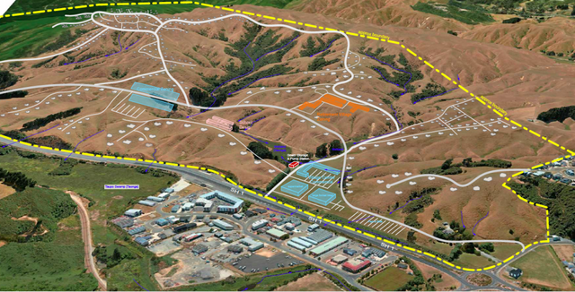
Have your say on Plimmerton Farm development
- Pukerua Bay Residents Association
- Submissions close 5pm, Thursday 2 JulyPorirua City Council (PCC) is changing its District Plan to use a fast-track process for the Plimmerton Farm development, and is asking for the public to give their views on it.
- Accepted from Pukerua Bay Residents Association feed by tonytw1
- Tagged as:
- porirua
- consultation
Porirua, Wellington Region, New Zealand (OpenStreetMap)
-
-
-
2020 Advertising Scouting
- Ngati toa Sea Scouts
- Last Thursday night, the scouts went off and were instructed to prepare a video that would advertise scouting to the rest of the world. This is what two groups (and the leaders) came up with: CUBS SCOUTS GROUP
- Accepted from Ngatitoa Sea Scouts feed by feedreader
- Tagged as:
- scouts
- video
-41.0984033, 174.8651878
-
-
-
Halted Transmission Gully Progress requires urgent answers
- Porirua Chamber of Commerce
- The continued delays and uncertainty on Transmission Gully’s progress must be explained says the Porirua Chamber of Commerce. “Currently the community…
- Accepted from Porirua chamber news 2020 by feedreader
- Tagged as:
- porirua
- transmission-gully
Transmission Gully Motorway, Kenepuru, Porirua, Porirua City, Wellington, 5022, New Zealand (OpenStreetMap)
-
-
-
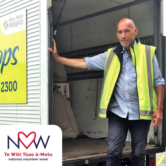
National Volunteer Week: Colin
- Mary Potter Hospice
- Every day across Wellington, Porirua and Kāpiti, Mary Potter Hospice is collecting used goods for its Hospice shops. Behind some of those collections is Colin.
- Accepted from MPH news by feedreader
- Tagged as:
- porirua
- wellington
Porirua, Wellington Region, New Zealand (OpenStreetMap)
-
-
-
Porirua's Love Local Expo
- Porirua Chamber of Commerce
- Showcase your business: Exhibitor applications open now! The Porirua Love Local expo is a showcase of what our community has to offer. The Council,…
- Accepted from Porirua chamber news 2020 by feedreader
- Tagged as:
- porirua
- business
Porirua, Wellington Region, New Zealand (OpenStreetMap)
-
-
-

MSP lower Norths colours at Porirua Park in Swindale Shield season opener
- Wellington Club Weekly
- Above: Stokes Valley have joined the Harper Lock Shield Premier Reserve competition this season, missing out to Paremata-Plimmerton’s second team 25-12 in today’s opening round of Wellington club rugby competition matches. More below. Results HERE Last July’s season rankings meant little at Jerry Collins Stadium today as the 2019 tier two Hardham Cup champions Marist...
- Accepted from Club Weekly 2020 by feedreader
- Tagged as:
- paremata
- porirua
- stokes-valley
- stadium
- wellington
- swindale-shield
Stokes Valley, Lower Hutt, Lower Hutt City, Wellington, 5019, New Zealand (OpenStreetMap)
-
-
-
Porirua business confidence continues to fall, supporting business recovery must be the focus
- Porirua Chamber of Commerce
- Business confidence in Porirua has fallen for the third quarter in a row, according to the recent results of the latest Porirua Chamber of Commerce survey. …
- Accepted from Porirua chamber news 2020 by feedreader
- Tagged as:
- porirua
- art
- business
Porirua, Wellington Region, New Zealand (OpenStreetMap)
-