Geotagged / Transmission Gully
Near me
-
-
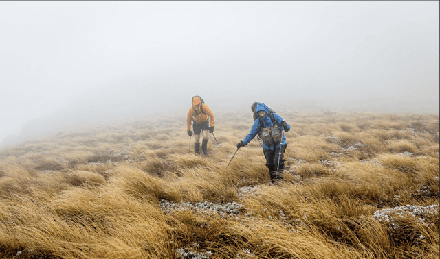
Ruahine Corner – Ruahine Forest Park
- Wellington Tramping and Mountainneering Club
- As the sun rose over Wellington on ANZAC Day morning, four trampers hurtled through Transmission Gully, bound for Mangleton Road and Ruahine Forest Park. Google was telling us that the difference in travel time between the SH1 or SH2 from Wellington and Woodville was negligible. The closure of Kereru Road, near Kereru itself, due to ... Read more
- Accepted from WTMC news 2020 by feedreader
- Tagged as:
- transmission-gully
Transmission Gully Motorway, Kenepuru, Porirua, Porirua City, Wellington, 5022, New Zealand (OpenStreetMap)
-
-
-
Roadkill and official information release shows growing mustelid pest problem for region
- Greater Wellington Regional Council
- In bad news for birdlife, roadkill and trappings have shown that Transmission Gully is a mustelid highway - with stoats, ferrets and weasels among the animals using it to get around. An official information release from Waka Kotahi NZ Transport agency shows 226 pests were trapped between November 2022 and January 2024, with rats, stoats, weasels, hedgehogs, mice, ferrets, possums, and rabbits all making the list. Chair of Greater Wellington, Daran Ponter, says that the news is worrying for conservation efforts like Capital Kiwi and Predator Free Wellington and that current central government budgets are wholly inadequate.
- Accepted from GW news 2022 by feedreader
- Tagged as:
- conservation
- transmission-gully
Transmission Gully Motorway, Kenepuru, Porirua, Porirua City, Wellington, 5022, New Zealand (OpenStreetMap)
-
-
-
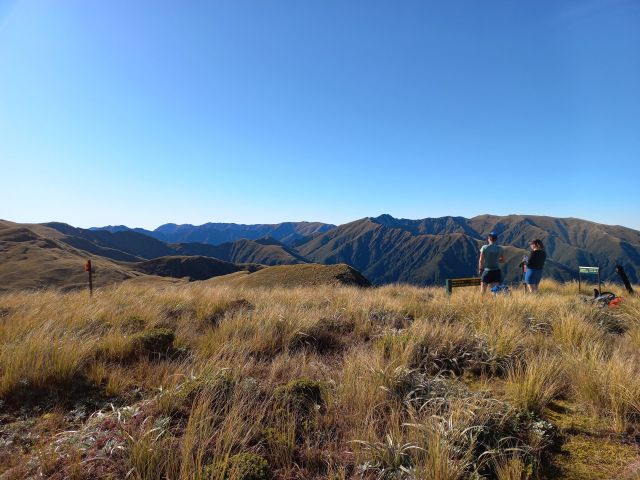
Triangle Hut
- Wellington Tramping and Mountainneering Club
- Note: A Personal Locator Beacon was activated on this trip. Read this article to learn more about the club’s response. On Friday afternoon we set off from Wellington station, picking up Anna at Melling Station on the way before testing out the new transmission gully route to Waikanae where we picked up a tramper from ... Read more
- Accepted from WTMC news 2020 by feedreader
- Tagged as:
- waikanae
- transmission-gully
Transmission Gully Motorway, Kenepuru, Porirua, Porirua City, Wellington, 5022, New Zealand (OpenStreetMap)
-
-
-
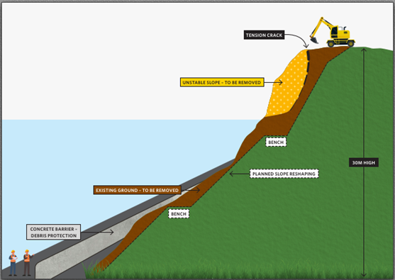
SH59 Pukerua Bay Hillside Stabilisation
- Pukerua Bay Residents Association
- Waka Kotahi has provided an update on the measures being taken to lessen the threat of further slips. This work is going to several weeks. The opening of Transmission Gully … SH59 Pukerua Bay Hillside Stabilisation Read More »
- Accepted from Pukerua Bay Residents Association feed by feedreader
- Tagged as:
- pukerua-bay
- transmission-gully
Transmission Gully Motorway, Kenepuru, Porirua, Porirua City, Wellington, 5022, New Zealand (OpenStreetMap)
-
-
-
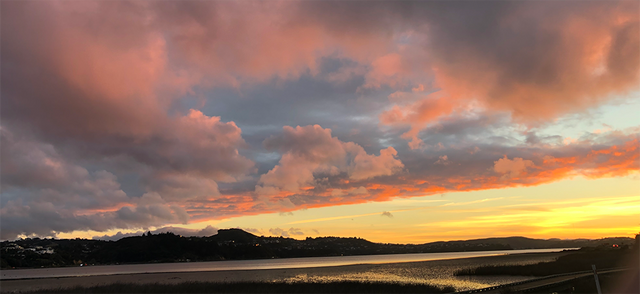
Rangihaeata’s big adventure
- Eye of the Fish
- So today Transmission Gully was opened – blessed, ribbon cut, journos let through, and a few selected souls have had access. Tomorrow, it opens to...
- Accepted from Eye of the Fish feed by tonytw1
- Tagged as:
- transmission-gully
- cannons-creek
Cannons Creek, Porirua, Porirua City, Wellington, 5025, New Zealand (OpenStreetMap)
-
-
-
Regional Chambers Call for Independent Inquiry into Transmission Gully Fiasco
- Porirua Chamber of Commerce
- The news that Transmission Gully is already being resurfaced, even though still months away from its well overdue opening, illustrates the giant…
- Accepted from Porirua chamber news 2020 by feedreader
- Tagged as:
- transmission-gully
Transmission Gully Motorway, Kenepuru, Porirua, Porirua City, Wellington, 5022, New Zealand (OpenStreetMap)
-
-
-
Project Contractor held to account for illegal works
- Greater Wellington Regional Council
- CPB HEB Joint Venture (the JV), the contractor building the Transmission Gully Motorway for Waka Kotahi (NZTA), has been convicted and fined for unconsented earthworks and sediment discharges in Belmont Regional Park.
- Accepted from GW media releases 2019 by feedreader
- Tagged as:
- transmission-gully
Transmission Gully Motorway, Kenepuru, Porirua, Porirua City, Wellington, 5022, New Zealand (OpenStreetMap)
-
-
-
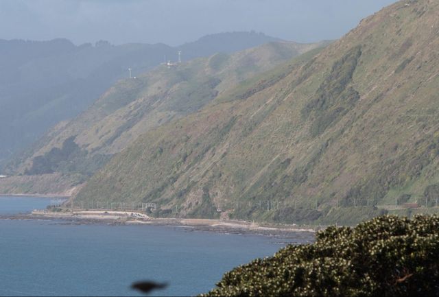
August 2020 Residents Association meeting minutes
- Pukerua Bay Residents Association
- Tuesday, August 11, 2020Pukerua Bay RSA, 5-7 Wairaka Road Present: Paul FitzGerald (Chair), Nikky Winchester (Secretary), Iain McLean, Kate Dreaver, June Penhey, Margaret Blair, Mel Galletly, Bill Jackson, Nathan Waddle (PCC)Community: Pat Hanley, Moira LawlerApologies: Pauline Morum, Jonathan Harker, Jenny Brash (GWRC)Approval of previous minutes: moved Iain McLean, seconded Bill Jackson, none opposed, carried. Porirua City Council update Nathan explained that the District Plan has been approved, and PCC is now taking feedback and submissions on it; it will go into action in early 2021. PCC is about to start running workshops on the Long Term Plan. A workshop is being held tomorrow with NZTA regarding the plans for revocation of SH1 and SH58 post-Transmission Gully. Matters arising Iain, Kate and Nikky met to discuss the Village Planning survey. Kate has since talked to PCC about whether they will pay for design, advertising and printing. The hope is to get the survey circulated soon, and to organise a drop-in session one Saturday at St Mark’s. The intention is to present the results at this year’s AGM. Financial $0.14 interest has been received this month. Correspondence No correspondence has been received. Progress on action items Action: Bill/Jon to discuss options for cloud storage. The Committee confirmed a strong preference to use a free public service, rather than a paid service. Action: Jon to add the information about the 25 memorials around the village to the RA website once Margaret has collected the information.Action:Jon and Pauline will meet as the new Fundraising committee, and present proposals to the Committee.Action:Pauline/Iain/Kate to continue investigating options for organising a silent art auction in November/December.Action:Margaret to remove Brian Sullivan and Pauline Morse as signatories from the PKBRA bank account as they are no longer committee members.Action: Margaret/Nikky to discuss the process for adding Nikky to the list of signatories.Action: Paul to write a proposal about amendments to the RA Constitution.Action: Iain/Paul to ask PCC to send their monthly updates to secretary@ and chair@ and remove all other names from their mailing list.Action: Jon to ask Dave Pepperell about posting information on the website about the Surfers Seat event.Action: Jon to create a page for He Ara Pukerua on the RA website.Action: Margaret to organise the seat plaque for Ernie Amey and Kath Fowler. Projects update Muri Platform building The signed lease papers have not yet been received back from Kiwirail confirming the lease. This should be in hand before the official launch event on 5 September. Action: Iain/Paul to follow up with Kiwirail. Food forest/community garden and He Ara Pukerua The Muri Station platform building and panels will be formally opened by the Mayor on Saturday 5 September at a launch commencing at 10.30am, followed up with tours around the food forest, where entertainment and refreshments will be available. Paul has asked PCC if the trees around the platform can be trimmed in advance of the event. Action: Jon to create a page on the RA website. Penguin survey Pauline Morum forwarded an email from Glenda Robb at the Kapiti Coast Biodiversity Project. A survey will be carried out in late September with a penguin dog, to track the local little blue penguins. Glenda has offered to do a brief talk at the September Committee meeting. Action: Paul to respond to Glenda and invite her to talk at the Committee meeting on 8 September.Action: Jon/Nikky to promote meeting/talk online.Action: Iain to look for name of DOC contact person re the installation of new signage about keeping dogs on a lead at the beach. Waste Free PKB Waste Free PKB’s collections have been extended to include metal beer bottle caps and wine bottle tops, metal jar lids, metal and plastic drink bottle tops, milk bottle caps, bread tags, can tabs, eyeglasses, facial skincare product packaging (plastic and glass containers plus lids, droppers and other complex closures), and writing instruments (including pens, felt tip pens, highlighters, markers, mechanical pencils and correction fluid – but not wooden pencils and chalk). This is in addition to the collections that have been in place since January 2019, which includes oral health products (toothbrushes, clean and empty toothpaste tubes and dental floss containers), AA and AAA batteries, and a number of different brands of coffee capsules. Action: Bill to investigate possibility of recycling computer equipment. AGM The AGM needs to be held in October, probably after the October committee meeting (scheduled for 13 October). It was suggested that Glenda Robb be asked to present the results of the penguin survey. Action: Paul to investigate a suitable date for using the School and Community Hall. Other business NZTA are keen to further extend Ara Harakeke; the next stage is from Pukerua Beach Road along SH1. A surveyor will be considering a possible route so as to avoid the slope and zigzag. Meeting ended: 8.25pmNext meeting: 8 September 2020
- Accepted from Pukerua Bay Residents Association feed by tonytw1
- Tagged as:
- transmission-gully
- recycling
- kapiti
- porirua
- penguins
- pukerua-bay
Pukerua Bay, Porirua, Porirua City, Wellington, New Zealand (OpenStreetMap)
-
-
-
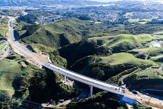
Transmission Gully: urgent review of delays and cost increases
- Wellington Scoop
- Accepted from Wellington Scoop features by feedreader
- Tagged as:
- transmission-gully
Transmission Gully Motorway, Kenepuru, Porirua, Porirua City, Wellington, 5022, New Zealand (OpenStreetMap)
-
-
-
Transmission Gully, better late than never
- Porirua Chamber of Commerce
- News today that Transmission Gully will open September 2021, over a year and half later than it was initially scheduled, is better late than never, says the Porirua…
- Accepted from Porirua chamber news 2020 by feedreader
- Tagged as:
- porirua
- transmission-gully
Transmission Gully Motorway, Kenepuru, Porirua, Porirua City, Wellington, 5022, New Zealand (OpenStreetMap)
-
-
-
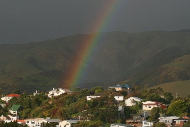
July 2020 Residents Association meeting minutes
- Pukerua Bay Residents Association
- Tuesday, July 14, 2020Pukerua Bay RSA, 5-7 Wairaka Road Present: Paul FitzGerald (Chair), Nikky Winchester (Secretary), Iain McLean, Kate Dreaver, Margaret Blair, Mel Galletly, Bill Jackson, Pauline Morum, Nathan Waddle (PCC), Jenny Brash (GWRC)Community: Brian SullivanApologies: June Penhey, Jonathan HarkerApproval of previous minutes: with amendment to note that Jenny Brash is heavily involved in monitoring the GWRC submission on the Plimmerton Farm development; moved Iain McLean, seconded Kate Dreaver, none opposed, carried. Porirua City Council update Nathan explained that submissions have closed for the Plimmerton Farm development. The annual plan has been finalised, with a rates increase of 4.9%. PCC are in the early stages of sorting out the long term plan for next year. The district plan will be discussed at the Council meeting tomorrow night; this will be effective from the start of next year. All new builds will be required to have grey water tanks. There was some discussion about the next steps for the Plimmerton Farm development. Greater Wellington Regional Council update Jenny explained that there is low leakage in the water treatment pipes. There will be workshops run by DIA regarding the proposal for large scale water authorities. The Government is subsidising losses incurred as a result of making the trains and buses free during Lockdown. Jenny suggested individuals consider writing to the Minister of Transport to push for Transmission Gully to be finished promptly. GWRC are expecting a report in August on the feasibility of introducing water meters. Financial Main account: $5737.47Fundraising: $0.00 Payment of $621.25 was made to AON NZ for renewal of public liability insurance through to June 2021.Of the monies in the main account, $4263.05 is for the community garden, $588.45 is for Surfers Seat maintenance, and $425.80 is for He Ara Pukerua.Margaret proposed that the RA set up a secure Cloud account for ease of access and an accessible archive, so this knowledge is independent of any individual or office holder, with read-only for general access by the rest of the Committee. Motion: The Residents Association Committee nominate Nikky Winchester to be the fourth bank signatory – moved Kate Dreaver, seconded Mel Galletly, none opposed, carried. Action: Bill/Jon to discuss options for cloud storage.Motion:Action: Margaret/Nikky to discuss the process for adding Nikky to the list of signatories. Correspondence Received (date?) a letter from BNZ who are phasing out cheques by June 2021. Progress on action items Action: Jon to add the information about the 25 memorials around the village to the RA website once Margaret has collected the information.Action: Jon and Pauline will meet as the new Fundraising committee, and present proposals to the Committee.Action: Pauline/Iain/Kate to continue investigating options for organising a silent art auction.Action: Paul to give Pauline contact details for Pauline Morse.Action: Margaret to remove Brian Sullivan and Pauline Morse as signatories from the PKBRA bank account as they are no longer committee members.Action: Paul to write a proposal about amendments to the RA Constitution.Action: Iain/Paul to ask PCC to send their monthly updates to secretary@ and chair@ and remove all other names from their mailing list.Action: Jon to ask Dave Pepperell about posting information on the website about the Surfers Seat event. Projects update Muri Platform building Iain confirmed with KiwiRail that the Committee would like to include some additional land in the lease. The updated lease has been signed and Iain expects to receive the copy shortly. Food forest/community garden Paul talked to Bill Inge about getting QR code plaques printed. It costs about $29 per plaque. He Ara Pukerua Brian informed the Committee that the group met via Zoom on a weekly basis during Lockdown. They have two major items to finish: the last bollard in the latest batch has been approved by Ngati Toa (Mt Welcome sign); and other signs are to go up shortly, including the ones at Muri Station. The timeline on the outside of the station building will be visible from the approach along the platform. The Muri Station platform building will be formally opened on Saturday 5 September at 10.30am, in conjunction with tours around the food forest, entertainment and refreshments. It will be 135 years since the railway arrived in Pukerua Bay. Action: Jon to create a page on the RA website. Community shed proposal There was some discussion about the naming of the proposal. It was agreed that it continue to be known as the “community shed”, and that it will be available to all members of the community. A MenzShed group may be established, and they will be able to use it at pre-arranged times, as will other community groups. Other business Kate reminded the Committee that the Hub was intending to do some research into loneliness, community connection and resilience. As a result of the village’s activities during the Covid-19 lockdown, Kate has written a proposal which has gone to Porirua Council. Iain and Kate have made further changes to the Village Planning survey. There will be a meeting on 25 July to discuss promotion and circulation of the survey. Margaret notified the Committee that there is a seat near the footbridge which is unnamed. Ernie Amey used to walk past it every day; and Kath Fowler was instrumental in getting the seat established. Margaret has spoken to PCC about putting a plaque on the seat to commemorate both of them. This will cost about $30. Action: Margaret to organise the plaque. Meeting ended: 8.51pmNext meeting: 11 August 2020
- Accepted from Pukerua Bay Residents Association feed by tonytw1
- Tagged as:
- porirua
- pukerua-bay
- covid-19
- transmission-gully
Transmission Gully Motorway, Kenepuru, Porirua, Porirua City, Wellington, 5022, New Zealand (OpenStreetMap)
-
-
-
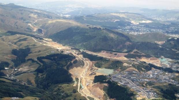
Transmission Gully: PPPs, infrastructure and mythical sagas
- Talk Wellington
- Some great journalism’s been unpicking the myth, machinations and money of the megaproject.
- Accepted from Talk Wellington posts by feedreader
- Tagged as:
- transmission-gully
Transmission Gully Motorway, Kenepuru, Porirua, Porirua City, Wellington, 5022, New Zealand (OpenStreetMap)
-
-
-
Plimmerton Farm: getting greenfields right
- Talk Wellington
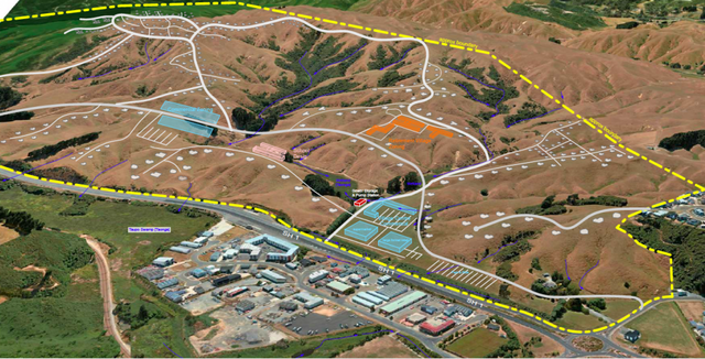
- If we’re hellbent on doing more residential development in greenfields, what does “decent” look like in Plimmerton, hilly land near an existing suburb – like most of our region’s greenfields? This post is basically a guide for anyone who cares about Plimmerton, good urban development, or healthy wetlands, streams and coast, but is time-poor and can’t face going through the truckloads of documents they’ve stuck up without any specific meta-guidance (some FAQ are here). Hopefully this will help you pop in a submission! PCC’s “information” pages they suggest you use for submitting. Every one of these is a large PDF document, 90% written in technical language… aargh! The background: what where and how For those who don’t know, Plimmerton Farm’s a big proposed subdivision of hilly farmland draining into the significant Taupō Wetland and to Plimmerton Beach, just over the train line and highway from Plimmerton village (original Ngāti Toa name: Taupō). It’s going through a Streamlined Planning Process, a pre-COVID government scheme for accelerating development. The key step is the requisite change of the land’s zoning in the Porirua District Plan (“rural” zone to “residential” and other “urban” zones) that sets out what kind of stuff can then be built, where. It’s mostly streamlined because there’s just one shot for the public to have input on the plan change. One shot. Why submit? I was born and raised in Plimmerton, live here now, and intend to for the rest of my days. I’d love to see it grow, well. I would love Plimmerton to get more wallets, more hearts and minds, more faces (more diverse ones too!). But not with more traffic, and pointless damage to our environment. Right now, the proposal has some serious flaws which need sorting. I say Sorting because the changes won’t make it crazy innovative, just good enough for a development in the spot it is, being kicked off in 2020. Time matters too: there’a a bunch of good things happening imminently (and some bad Porirua trends that need to be reversed). I cover these in Get it right, below. It’s worth submitting because given the situation, a 1990s-grade development just won’t cut it. So what about Plimmerton Farm needs to change? It boils down to two themes: dial down the driveability and dial up the liveabilitymake Local the logical and easy choice for daily needs I’ll outline what needs to change in each. NOTE: There’s a third – don’t stuff the wetlands and streams. This is really important as Taupō Wetland is regionally significant, and all our streams and harbours have suffered from frankly shameful mismanagement of sediment from earthworks-heavy subdivisions like Aotea and Duck Creek, and from the earthworks-a-rama of Transmission Gully. Friends of Taupo Swamp have an excellent submission guide for you – add in some of their suggested bits to your submission. I: Dial down the driveability, dial up the liveability There aren’t many truly black-and-white things in life, but there’s one for towns: If a street is nice to drive in, it’ll be a crappy place to do anything else in (walk / eat / hang out / have a conversation / play / scoot or cycle / shop / have a pint). If it’s nice to do anything else in, it’ll be a crappy place to drive in. Mostly this is because of the nature of the automobile: big solid things that smash into our soft bodies if someone makes a mistake (75% odds of death if that’s at 50km/hour, 10% odds of death if at 30km/hour) big objects that need lots of space for manoeuvering and especially parking – which offstreet can be crazy expensive and push up the cost of a home, and onstreet hoover up valuable public space. big solid things driven by us real humans (for a while at least) who respond to the environment but also get distracted, and generally aren’t good at wielding these big solid things safely. The transport setup proposed for Plimmerton Farm makes for a much too driveable and poorly liveable place. 1. Narrow down all the roads. The current proposal’s roading setup has roads and streets that are too big, and there’s too much of them. Right sized roads for a liveable community The cross-sections for the roads include on-street parking and really wide lane widths. This is really gobsmacking for a consortium that talked a big talk about good practice. For all the reasons that Low Traffic Neighbourhoods are good, this is bad. (And it’s especially nuts when you realise that the excessively wide “arterial” roads (11 metres!) will need earthworked platforms built for them where they’re drawn running up the sharp ridges and across the tops of gullies. Expensive, damaging for the environment, and … what were they thinking?) So recommended changes: NARROW DOWN THE ROADS. Seriously. Design all the living-area streets and roads, and the centre, to be self-explaining for an operating traffic speed of 30km or less – that’s the speed where mistakes are rarely fatal. What does that look like? The designers will know and if they don’t they should be fired. Narrower crossing distances; chicanes (great way to incorporate green infrastructure and trees and seating!); narrowed sight-lines (trees! sculpture!) so no-one driving feels inclined to zoom. Reduced trafficked lanes (rori iti on the larger roads!), with properly wide and friendly footpaths. Threshold treatments, humps, modal filters, all the things we know very well are the natural ways to slow us down when driving, and make streets nicer for people. The beauty of all this “restriction” on driving is how much it frees us up for making everything else appealing. Streets become hospitable for kids to walk, scoot, bike to school safely, using the road not the footpath. Older people and those with impairments can walk and wheelchair safely. Teens coming home from town of an evening can scoot or bike home, safely. Popping down to the shops or for a coffee or to the train becomes a pleasure to do on foot, or on a scooter or bike. And you’re moving in a legitimate way – seeing and being seen, not stuck off in the bush on a “recreational” track like what they’ve described. The ordinary streets and roads are walkable, bikeable, scootable, mobility-scootable, and perfectly driveable, equally safe and useable in all weathers and anytime of day or night. Used to be a big, fast road. Now, kids bike to school and old people can chill out on it. (Mark Kerrison) (And in case you’re worried about firetrucks / rubbish trucks / buses, recall that on even Wellington City’s far more winding, narrower hilly streets everyone gets their rubbish collected and fires fought just fine. On public transport, smaller buses, like those that community transport operators use, are the way of the future for less densely-populated areas like this). Don’t build the through and loop roads. You don’t need signs like this when the only people who bother to drive in are those who live there, or who are visiting friends, because you just have to drive out again the way you came. When it’s the place you live, you’re invested in not being a dick far more than if you’re just out for a drive – or worse, out for a bit of a boyrace hoon on a massive loop route through a whole place. So just don’t build those big connector roads that enable people to drive easily from one residential area to the next, especially the ones up in the hilltops (section C) that just say “come for a hoon!” Instead, connect the living spaces heavily with bikeable, walkable, scootable, disability-friendly streets and lanes, and as much as possible, only one way in and out for cars from each living area. II: Make local logical and easy Plimmerton is a true village, with a great little centre (including a train station!) but Plimmerton Farm is ultimately a damn big area. The way to go is to enable people to get the basics of life – like school, groceries, a coffee – with a little local trip on foot, bike or scooter – it’s more of a bother to get in the car. Right now though, it needs two changes: 1. Provide for a second centre “Bumping into” spaces are known to be crucial to a feeling of neighbourhood, and in the (initial) absence of third places (worship places, community hall, sports club, cafe/pub, a supermarket is a vital social centre. Yet the north end of Plimmerton Farm is currently a deadzone for anything except residential. What things will probably look like under current layout. Like in Edwards Scissorhands without the interest of a castle. There’s no provision for a place to do your household groceries, so people will drive to Mana New World – more car trips – and less opportunity to bump into people who live nearby. (There’ll be no school in Plimmerton Farm for a while, because Ministry of Education isn’t allowed by the Education Act to build a school somewhere until there’s a certain population density of kids to fill it. A shitty Catch-22 for developments which is hopefully going to be fixed … sometime. Just another reason to make walking, biking and scooting really kid-friendly, as extra dropoff traffic for kids going to St Theresa’s, Plimmerton School, Paremata and Pukerua Bay schools will be a nightmare.) So they should provide for an additional centre in the north, including a groceries place of some kind. 2. Intensify within walking distance of Plimmerton proper. We should intensify properly, with lots of medium and even some high density (6 storeys of nicely laid-out density done well!) in the area that’s within a 5-minute walk of Plimmerton Village. The more people can live and work with access to all its many amenities, and its rail station (10 min to Porirua, 30 min to Wellington), the better. But there’s not enough density provided for there. Plimmerton Railway station: buzzing in 1916 and has only got bigger. (Photo: Pātaka Porirua Museum) So they should add another zone – E – of higher density in that 5-minute walking catchment of Plimmerton Village. What could it look like? A good example is 3333 Main, Vancouver . Submission tips On the site they ask you to fill in a Word or PDF form, saying which specific bit of the gazillion proposals you are talking about and the specific changes you want. This is a BS way to treat the vast majority of people submitting: normal non-professionals, just regular people who care about good development and liveable places. So just don’t worry about that. In those question 6 column boxes just put “Transport” and “Layout”. It’s the professional planners’ job to figure out specifically how to change a planning document. Just be specific enough that they know what you want to see. The text above is worth copying and pasting – it’ll be enough. And don’t forget the Friends of Taupo Swamp and Catchment advice is essential – definitely go read and use. That’s all you really need – just go submit! But if you’re keen to know more reasons why they should be doing this better, here’s some… Get it right, now Once this plan change is through, traditional developers like Gillies like to whack in all the infrastructure – hello, massive earthworks. And yet the place will take decades to fill with actual people – those hearts and minds and wallets. (Note even before COVID, Porirua’s growth rate was 0.1% per year. Yep, one tenth of one percent.) And extra pressure’s on to do this better because all these things are features of the next one to three years: the One Network Road Classification (sets the design specs for roads of different types) is being updated right now to be more people-friendly in the specs for roads in residential and centre areas, so designs like Plimmerton Farm’s will soon be Officially Bad Practice Sales and riding of e-bikes and e-scooters are going through the roof, continuing through and beyond COVID – this shows no signs of slowing, and prices are dropping. E-power flattens the hills of Plimmerton Farm and makes wheely active travel a breeze for the middle-class people who’ll be living here, if the streets and roads are hospitablePlimmerton Railway Station (on the most popular Wellington train line) is being upgraded to be a terminus station – i.e. better servicesThe Wellington Regional Growth Framework is setting a bunch of directions for councils on how to grow well, including well-known but often well-ignored issues like intensifying around public transport hubs Councils will soon be required to do to a bunch of a bunch of international good practice including get rid of many minimum parking requirements (in the news lately), and to upzone (enable intensification) of landuse in the walking catchment of public transport hubs. (5 min walk = approx 400 metres, 10 min = 800m).Bad trends we need to stop: Porirua’s really high car-dependency (we own cars a lot and drive a lot) is continuing, due to car-dependent urban form [PDF]– despite nice words in council’s strategic intentions.People living outside Wellington City are mostly to blame for our region’s 14% increase in emissions from transport in just 10 years. OK go submit now – and share with anyone who you think might care!
- Accepted from Talk Wellington posts by feedreader
- Tagged as:
- paremata
- porirua
- transmission-gully
- sculpture
- government
- parking
- design
- covid-19
- law
- planning
- wellington
- education
- developments
- sport
- buses
- coffee
- zoo
- people
Porirua, Wellington Region, New Zealand (OpenStreetMap)
-
-
-
Halted Transmission Gully Progress requires urgent answers
- Porirua Chamber of Commerce
- The continued delays and uncertainty on Transmission Gully’s progress must be explained says the Porirua Chamber of Commerce. “Currently the community…
- Accepted from Porirua chamber news 2020 by feedreader
- Tagged as:
- porirua
- transmission-gully
Transmission Gully Motorway, Kenepuru, Porirua, Porirua City, Wellington, 5022, New Zealand (OpenStreetMap)
-
-
-
Porirua Chamber - Opportunities post Transmission Gully, but Porirua has to seize them
- Porirua Chamber of Commerce
- There was a strong message heard loud and clear from last night’s business briefing on Transport, says Porirua Chamber of Commerce chair Heather Hutchings.…
- Accepted from Porirua chamber news 2020 by feedreader
- Tagged as:
- porirua
- transmission-gully
Transmission Gully Motorway, Kenepuru, Porirua, Porirua City, Wellington, 5022, New Zealand (OpenStreetMap)
-
-
-
Taking The Wheel: The Government Makes More Moves To Rebalance Transport
- Save the Basin Reserve!
- As Wellington waits for an announcement in its transport future, the Government is continuing to make moves to reshape transport in New Zealand away from over-reliance on the private car and towards a balanced system that gives as many people as possible options for getting off the roads: The new Government Policy Statement on Land Transport represents a significant change away from the previous Government’s motorway-dominated transport priorities, as Isabella Cawthorn explains on Talk Wellington. On Newshub, Thomas Coughlan says that public transport is the big winner in the new strategy. The previous National-led Government was completely impervious to the well-accepted research finding that adding new capacity encourages more people into cars. The news that the Government is considering tolling Transmission Gully to help prevent this is an encouraging sign that the feared flood of additional cars into Wellington from the North may not materialise. While we wait to see whether the Government’s new, balanced approach will succeed in cutting Wellington’s motorway-building cabal off at the pass, why not find out how another seaside city, Vancouver, has succeeded in making its transport system work for people, not the other way around?
- Accepted from Save the Basin posts by feedreader
- Tagged as:
- transmission-gully
Transmission Gully Motorway, Kenepuru, Porirua, Porirua City, Wellington, 5022, New Zealand (OpenStreetMap)
-
-
-
Rare Native Falcon breeding in Takapu Valley? Looking good
- Save Takapu Valley
- We’ve had regular sightings of the rare Native New Zealand Falcon in Takapu Valley over the last few years (and some going back decades), BUT yesterday Rob Suisted (who owns land in upper Takapu Valley) photographed a pair of Falcons – kārearea (Falco novaeseelandiae), flying together, and vocalising (“ki-ki-ki-ki-ki-ki”), in what appeared to be courting… Read More
- Accepted from Save Takapu Valley posts by feedreader
- Tagged as:
- takapu-valley
Takapu Valley, Wellington City, Wellington, 5028, New Zealand (OpenStreetMap)
-
-
-
The Water is Wide – Flooding May 2015
- Save Takapu Valley
- 120 mm of rain in 24 hours, 60 of it in one hour. There was a fair bit of damage to public infrastructure. The Wellington water main was undercut in a few places, power poles were washed out and fell over, requiring replacement and relocation. Although this was a pretty epic flood, the… Read More
- Accepted from Save Takapu Valley posts by feedreader
- Automatically tagged as:
- lobby-groups
- takapu-valley
- tawa
- transmission-gully
Takapu Valley, Wellington City, Wellington, 5028, New Zealand (OpenStreetMap)
-
-
-
WCC, RTC and now GWRC adopt positions to protect Takapu Valley from motorway
- Save Takapu Valley
- 29 April 2015 – Greater Wellington Regional Council voted strongly against NZTA plans to put a road through Takapu Valley (http://www.
- Accepted from Save Takapu Valley posts by feedreader
- Tagged as:
- takapu-valley
Takapu Valley, Wellington City, Wellington, 5028, New Zealand (OpenStreetMap)
-
-
-
Common sense decision by Wellington City Council on Petone to Grenada Rd
- Save Takapu Valley
- On 14th April 2015, the Wellington City Council voted a strong (11/4) position on the Petone to Grenada Road proposal, and the last minute additions of either widening SH1 past Tawa (option C), or a new road through Takapu Valley (option D). Their decision was to SUPPORT the Petone to Grenada Link Road proposal (which… Read More
- Accepted from Save Takapu Valley posts by feedreader
- Tagged as:
- tawa
- takapu-valley
Takapu Valley, Wellington City, Wellington, 5028, New Zealand (OpenStreetMap)
-
-
-
Takapu Valley: Last clean headwaters of Porirua Harbour. Protect it from NZTA
- Save Takapu Valley
- NZTA are proposing a big road through the last undeveloped headwaters of Porirua Stream, which is a major tributary of the Porirua Harbour system. Last week Wellington City Councillors voted to endorse the new Te Awaura-O-Porirua Harbour and Catchment Strategy Action Plan to clean up the Porirua catchment. Surprisingly, Councillors weren’t even told by officials… Read More
- Accepted from Save Takapu Valley posts by feedreader
- Tagged as:
- takapu-valley
- porirua
Takapu Valley, Wellington City, Wellington, 5028, New Zealand (OpenStreetMap)
-
-
-
Takapu Valley: Last clean headwaters of Porirua Harbour. Protect it from NZTA
- Save Takapu Valley
- NZTA are proposing a big road through the last undeveloped headwaters of Porirua Stream, which is a major tributary of the Porirua Harbour system. Last week Wellington City Councillors voted to endorse the new Te Awaura-O-Porirua Harbour and Catchment Strategy Action Plan to clean up the Porirua catchment. Surprisingly, Councillors weren’t even told by officials… Read More
- Accepted from Save Takapu Valley posts by feedreader
- Tagged as:
- porirua
- takapu-valley
Takapu Valley, Wellington City, Wellington, 5028, New Zealand (OpenStreetMap)
-
-
-
P2G and WGTN Resilience, Part 2: EQ and Natural Hazard Resilience
- Save Takapu Valley
- This is the second of three posts examining the effects of the proposed Petone to Grenada link road on the network and natural hazard resilience of the Wellington road network. This post covers Earthquake and Natural Hazard Resilience. Part 1 looks at network resilience. Part 3 takes a closer look at the challenges of the… Read More
- Accepted from Save Takapu Valley posts by feedreader
- Automatically tagged as:
- lobby-groups
- takapu-valley
- tawa
- transmission-gully
Takapu Valley, Wellington City, Wellington, 5028, New Zealand (OpenStreetMap)
-
-
-
P2G and WGTN Resilience, Part 3: The Hutt Valley
- Save Takapu Valley
- This is the third of three posts examining the effects of the proposed Petone to Grenada link road on the network and natural hazard resilience of the Wellington road network. This post looks at road access to the Hutt after a major event. Part 1 looks at network resilience. Part 2 examines earthquake and natural… Read More
- Accepted from Save Takapu Valley posts by feedreader
- Tagged as:
- hutt-valley
Takapu Valley, Wellington City, Wellington, 5028, New Zealand (OpenStreetMap)
-


