Geotagged / Island Bay cycle way
Near me
-
-
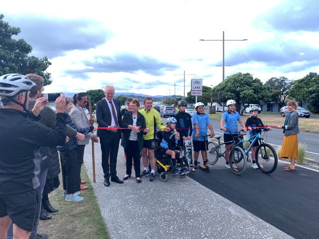
Making a Difference, 12 Years On…
- Sarah Free
- I was asked recently what I rated as my four biggest achievements on Council, and this was my reply: (spoiler alert, there are five) Cycling and Walking Improvements City-Wide: Along with quite a few uphill routes, there’s the Leonie Gill pathway, Evans Bay and Cobham Drive, the upgraded Island Bay cycleway and Town Centre- and […]
- Accepted from Sarah Free posts by feedreader
- Tagged as:
- island-bay
- cobham-drive-crossing
- island-bay-cycle-way
Cobham Drive, Kilbirnie, Wellington, Wellington City, Wellington, 6021, New Zealand (OpenStreetMap)
-
-
-
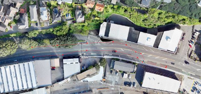
Thorndon Quay Upgrade Project – January 2025
- Thorndon Residents Assocation
- Construction update 2025 - Biking through Thorndon Quay, Cycleway surfacing and parking, Neat Places - neat results, Microgrants supporting small businesses, Whakahikuwai Awa karakia
- Accepted from TRA news 2019 by tonytw1
- Tagged as:
- thorndon
- island-bay-cycle-way
- parking
Thorndon, Wellington, Wellington City, Wellington, New Zealand (OpenStreetMap)
-
-
-
Feedback on Ngaio Cycleway
- Ngaio Progressive Association
- Im aware that we have residents who are in favour of the cycleway along Ngaio Gorge Road, and some who are very concerned about its impact. Here is an opportunity to easily give your feedback to Wellington City Council – … Continue reading →
- Accepted from Ngaio PA News 2020 by feedreader
- Tagged as:
- ngaio
- island-bay-cycle-way
- wellington-city-council
- consultation
Ngaio, Wellington, Wellington City, Wellington, New Zealand (OpenStreetMap)
-
-
-
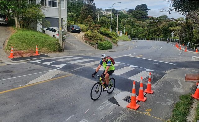
Ngaio Connections (Cycleway) Update
- Ngaio Progressive Association
- Changes on Kaiwharawhara Road and Cameron StreetWCC are on schedule to complete stage 1 of the Ngaio connection by early December, with changes being made on Kaiwharawhara Road and Cameron Street. On Kaiwharawhara Road, they will be installing: the uphill … Continue reading →
- Accepted from Ngaio PA News 2020 by feedreader
- Tagged as:
- ngaio
- island-bay-cycle-way
Ngaio, Wellington, Wellington City, Wellington, New Zealand (OpenStreetMap)
-
-
-
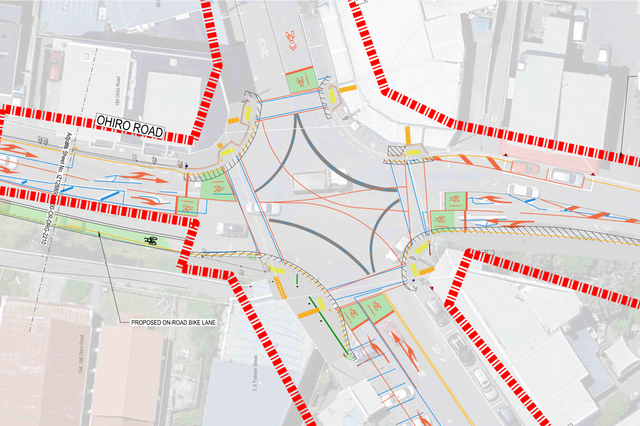
Brooklyn Hill cycleway
- Eye of the Fish
- I’m all in favour of cycleways – they are a great addition to the city, and may even allow me one day to ride a...
- Accepted from Eye of the Fish feed by feedreader
- Tagged as:
- brooklyn
- island-bay-cycle-way
- consultation
Brooklyn Road, Fitchettown, Mount Cook, Wellington, Wellington City, Wellington, 6021, New Zealand (OpenStreetMap)
-
-
-
Ngaio Crofton Downs Residents Association Annual General Meeting
- Ngaio Progressive Association
- 7:30pm Wednesday 16 November 2022, Ngaio Union Church (corner Kenya St /Crofton Rd) The Council’s Ngaio Cycleway Team will be joining our AGM discuss the proposed Ngaio Connection cycleway which will run from Kaiwharawhara to Ngaio. Consultation on the cycleway … Continue reading →
- Accepted from Ngaio PA News 2020 by feedreader
- Tagged as:
- ngaio
- consultation
- island-bay-cycle-way
Ngaio, Wellington, Wellington City, Wellington, New Zealand (OpenStreetMap)
-
-
-
Ngaio Connection Cycleway
- Ngaio Progressive Association
- Consultation is now open for 3 weeks, closing on 21 November – this link to the Council’s website provides plenty of information on the proposal, and how to make a submission: https://www.transportprojects.org.nz/current/ngaio-connection/supporting-documents/ All businesses and residents on the route should … Continue reading →
- Accepted from Ngaio PA News 2020 by feedreader
- Tagged as:
- ngaio
- island-bay-cycle-way
Ngaio, Wellington, Wellington City, Wellington, New Zealand (OpenStreetMap)
-
-
-
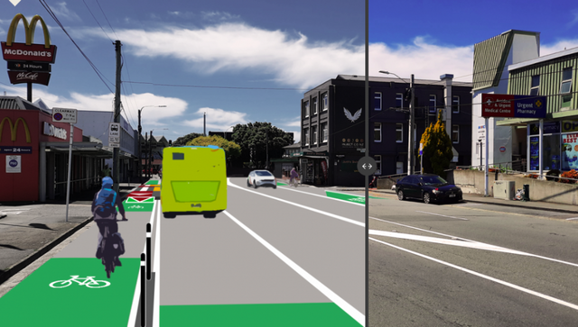
Smoother bussing and safer biking in Newtown? Now, or maybe not for a decade!
- Talk Wellington
- If you want a decently bikeable and more bus-friendly route between Newtown centre and the city, anytime within a decade, you need to give this a cheerful positive shove, now! Window closes this Wednesday! We have a partial separated cycleway and partial dedicated bus lanes in Newtown. Yes, you’ve probably submitted supportively on this before...
- Accepted from Talk Wellington posts by feedreader
- Tagged as:
- newtown
- island-bay-cycle-way
Newtown, Wellington, Wellington City, Wellington, New Zealand (OpenStreetMap)
-
-
-
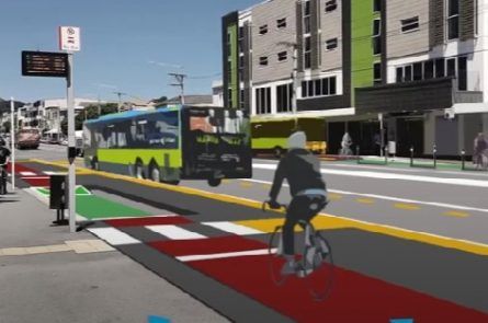
Cycleways to Ngaio
- Ngaio Progressive Association
- You may be aware25 of Paneke Pōneke – the bike network plan for Wellington. The plan guides the development of our cycle network and explains the approach, strategic rationale and how Wellington City Council will work with the community to … Continue reading →
- Accepted from Ngaio PA News 2020 by feedreader
- Tagged as:
- ngaio
- island-bay-cycle-way
- paneke-pneke
- wellington-city-council
Ngaio, Wellington, Wellington City, Wellington, New Zealand (OpenStreetMap)
-
-
-
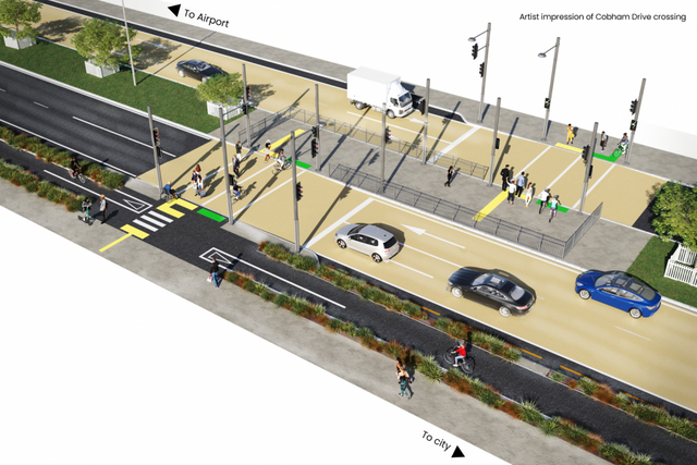
“See you in court!”: Cobham Drive, community groups, and judicial review
- Talk Wellington
- Posturing aside, what does it really mean for someone to legally challenge a roading authority’s decision – be it a cycleway, a road expansion, or a pedestrian crossing on Cobham Drive? “See you in court” – again Wellington Airport’s declaration of intent to torpedo a pedestrian crossing on Cobham Drive is fresh, but recently there’s been a...
- Accepted from Talk Wellington posts by feedreader
- Tagged as:
- cobham-drive-crossing
- island-bay-cycle-way
Cobham Drive, Kilbirnie, Wellington, Wellington City, Wellington, 6021, New Zealand (OpenStreetMap)
-
-
-
Parade Upgrade Submission Guide
- Cycle Wellington
- Wellington City Council wants to know what you think about improvements planned for The Parade in Island Bay. This work is long overdue. Cycle Wellington welcomes this work getting underway as soon as possible. Please add your support and have your say using our guidance below:
- Accepted from Cycle Wellington feed by feedreader
- Tagged as:
- consultation
- island-bay-cycle-way
The Parade, Island Bay, Wellington, Wellington City, Wellington, 6023, New Zealand (OpenStreetMap)
-
-
-
Island Bay Cycleway submission to WCC Planning and Environment Committee
- Island Bay Residents' Association
- 9 November 2021 From the Island Bay Businesses and Residents’ Association (IBRA) Re: Island Bay Cycleway Options to be discussed by the Council Planning and Environment Committee on Wednesday 10 November 2021.
- Accepted from Island Bay Residents' Association feed by tonytw1
- Tagged as:
- island-bay
- island-bay-cycle-way
Island Bay, Wellington, Wellington City, Wellington, New Zealand/Aotearoa (OpenStreetMap)
-
-
-

1500 days in Island Bay
- Wellington Scoop
- Last Friday was 1,500 days since the Wellington City Council voted 13-1 to upgrade The Parade in Island Bay. So why hasn’t the work started? Here’s a rundown of everything that’s happened (or not happened) in the four years since then.
- Accepted from Wellington Scoop features by feedreader
- Tagged as:
- island-bay
- island-bay-cycle-way
Island Bay, Wellington, Wellington City, Wellington, New Zealand/Aotearoa (OpenStreetMap)
-
-
-
Letter to Wellington City Council re: Island Bay cycleway
- Island Bay Residents' Association
- 21st April 2021 Ms Barbara McKerrow Chief Executive Wellington City Council Dear Ms McKerrow, Re: The Parade, Island Bay The Island Bay Residents’ and Businesses Association (IBRA) would like to see the concerns related to The Parade in Island Bay resolved.
- Accepted from Island Bay Residents' Association feed by tonytw1
- Tagged as:
- island-bay
- island-bay-cycle-way
- consultation
Island Bay, Wellington, Wellington City, Wellington, New Zealand/Aotearoa (OpenStreetMap)
-
-
-
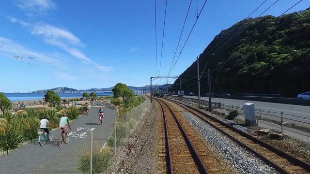
Te Ara Tupua
- Eye of the Fish
- One of Wellington’s long-desired and much awaited projects is apparently to get underway as part of the Government’s shovel-ready infrastructure projects: Te Ara Tupua, aka the Ngauranga to Petone Cycleway.
- Accepted from Eye of the Fish feed by tonytw1
- Tagged as:
- government
- petone
- wellington
- art
- island-bay-cycle-way
Petone, New Zealand (OpenStreetMap)
-
-
-
OBRA presentation to Council, 7 May 2020
- Oriental Bay Residents’ Association
- Re: Pop-up Cycleway and Removal of Angle Parking Thank you for inviting the Oriental Bay Residents Association to present today.
- Accepted from Oriental Bay Residents’ Association 2019 by feedreader
- Tagged as:
- oriental-bay
- island-bay-cycle-way
- parking
Oriental Bay, Wellington, Wellington City, Wellington, 6011, New Zealand (OpenStreetMap)
-
-
-
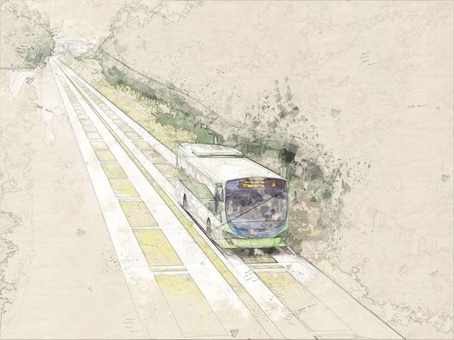
Waiting for light rail? Let’s build a busway now!
- Talk Wellington
- One question on the mind of everyone suffering from Wellington’s transport problems is – when will Let’s Get Wellington Moving actually get us moving? Guest poster Marko Garlick sees a supercharger hiding in plain sight There seem to be lots of abstract projects planned to be delivered, maybe years from now: urban State Highway 1 “improvement” with more tunnels, and a rapid (or maybe just frequent) mass transit line from Lambton through Newtown and to the Airport. But where will these actually go? And how do we deal with difficult questions about flows around the Basin Reserve? Wellingtonians waiting for new transport infrastructure to be built… Where does mass transit go? For mass transit, there are many things to consider. Is it along the waterfront quays or along Lambton Quay / the Golden Mile? Along Taranaki St or along Cambridge Terrace? Where does it go through the Basin Reserve? Many people are speculating. And the big one: light rail or trackless trams, or both? Mock-up of a route down Taranaki St What about the urban motorway? The LGWM proposal has a pretty good plan to maintain the amenity of the city above. They want to underground the motorway from the Terrace to Mt Vic. A new Te Aro park will be created on top. However people are questioning the need for more lanes created by a new Terrace and a new general traffic Mt Vic tunnel. More lanes in urban motorways creates induced demand. More lanes means make people drive more which kills off any travel savings created by the bigger road. It’s a transport strategy just as smart as trying to lose weight by buying bigger pants! Bigger roads take up valuable space and just fill up with more traffic (looking at you Auckland, thanks for showing us what not to do) This uncertainty is paralysing! Those who are in the “pro-car” camp say they like mass-transit but that must come after their bigger road. Those in the “pro-PT” camp want light rail first and a smaller road. Finger-pointing and party lines are drawn. Tough and costly decisions will have to be made about irreversible projects around the Basin. Once you make a flyover, tunnel or lay down tracks you can’t (quickly) go back. I think we can break out of this inaction and stupor with an interim middle ground: a busway. Case Study: Auckland’s Northern busway The idea for this has come from the success of Auckland’s northern busway. It is a dedicated two-lanes for buses from the northern foot of the Harbour Bridge up SH1 to Constellation Drive with world-class stations and frequent congestion-free services into the city. It has seen year-on-year double-digit growth numbers over its 11 years in service, and is being extended to Albany and beyond shortly. Eventually tracks will be laid down for a second-harbour crossing for light-rail. Radical incrementalism Initially the busway was just a narrow shoulder each side of the northern motorway. People were sceptical initially but its success was undeniable and has provided the basis for upgrades and extensions. What the Northern busway shows is that doing something now, and building on it, is more practical and politically palatable than trying to justify a massive spend up front. This is applicable to Wellington’s light rail situation. It is relatively low-cost initially, can display almost mass-transit qualities and is more flexible as progress is made towards light-rail. Why a busway? A busway is what Wellington needs now. We cannot wait another 10-15 years for a big decision on the Basin and Mt Vic tunnel. A busway will provide many benefits: It is far cheaper to implement right away and far quicker to implement (I envisage 3 years for the first stage).It also demonstrates demand for mass-transit and will allow us to see whether a certain route is a good idea or not.It also allows for land-use intensification now, providing greater density and amenity to a future light rail line. What will it look like? So what would this look like? I think that the busway should start at the train station, go along the waterfront quays, and then either go along Taranaki St or Cambridge/Kent Terrace. Ideally, it should run in the centre of street with weather protected stops and room for cycleway and signal-priority. Stops should mirror light rail ones, being spaced out for speed and reliability. Along most of the route the buses could probably hit 60km/h speeds, congestion free, all day. [Ed: just let that sink in. Congestion free. A clear run.] Separate branding would be an excellent addition. The Northern Express (NEX) is what Auckland has; the Wellington Express (WEX) is what we could have. This post is about incrementalism and the key takeaway is something half-done is better than waiting ages for the ‘perfect’ solution. If the busway is barebones at first before getting upgrades then so be it. The mess at the Basin can be avoided by stopping bus priority at the start, then resuming it into Newtown. This is what the Northern Busway does with dedicated lanes ending at the Harbour Bridge, then resuming on Fanshawe St. What the waterfront quays look like now (shudders). Hardly the “walkable city”. A thing of beauty: What a complete Wellington busway could look like The busway can be upgraded over time. Greenspace, cycleways, better stops, a possible underpass on Waterloo Quay to connect to the railway station. Summing up In an ideal world, we can all agree on the light-rail and grade-separation issues at the Basin and they may already have been implemented. But that is not the case. Although there is lots of details to work, the principle of a busway now then future conversion to higher-capacity light-rail is a sound one in my mind. Do you have any ideas why Wellington has not had bus priority – via a busway, or anything else – for so long? What do you think of fast buses in the city centre, and in the suburbs? A version of this post was originally published on TraNZport; see the original here. Image credits Cover image by Smarter TransportSkeleton waiting, original unknownTaranaki mock-up by LGWMAuckland rush hour by Getty imagesAuckland busway by Greater AucklandQuays now, screen grabBusway by AT
- Accepted from Talk Wellington posts by feedreader
- Tagged as:
- newtown
- waterfront
- island-bay-cycle-way
- lets-get-wellington-moving
Newtown, Wellington, Wellington City, Wellington, New Zealand (OpenStreetMap)
-
-
-
Newtown Connections
- Newtown Residents' Association
- For the past month Wellington City Council has been asking for community input on proposals for cycleway routes through Berhampore, Newtown and Mt Cook as part of the urban cycleways project.
- Accepted from NRA news by feedreader
- Tagged as:
- berhampore
- newtown
- island-bay-cycle-way
Newtown, Wellington, Wellington City, Wellington, New Zealand (OpenStreetMap)
-
-
-

New ways to waste money – it’s the #wadebrownwccway
- WCC Watch
- We got a little bored with the Island Bay cycleway debacle – and judging by the Mayor’s lack of support in the media Celia Wade-Bicycle is also giving her troubled Island Bay project a wide berth.
- Accepted from WCC Watch feed
- Tagged as:
- island-bay
- island-bay-cycle-way
Island Bay, Wellington, Wellington City, Wellington, New Zealand/Aotearoa (OpenStreetMap)
-
-
-
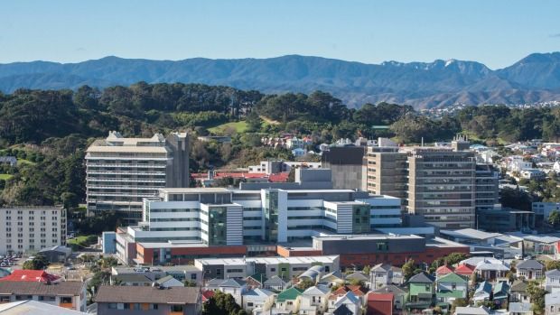
Council prioritises Chinese Garden and Cycleway over Hospital Water Supply
- WCC Watch
- Capital and Coast DHB Board Member and Porirua Mayor, Nick Leggett and Southern Ward Councillor, Paul Eagle, have highlighted a bizarre decision by Council to refuse to fund the emergency water reservoir that serves the Hospital.
- Accepted from WCC Watch feed
- Tagged as:
- island-bay-cycle-way
- porirua
Porirua, Wellington Region, New Zealand (OpenStreetMap)
-
-
-
We have the money – do we have the vision?
- Cycling in Wellington
- Wellington CBD Cycleways – an achievable vision? Following hard on WCC’s approval of the Cycling Framework, and the Island Bay Cycleway, the Government announceed another $296 million to be spent across the country under the Urban Cycleways Programme, bringing the total expenditure, including contributions from the National Land Transport Fund and local government, to $333 million.
- Accepted from Cycling in Wellington posts
- Tagged as:
- island-bay
- island-bay-cycle-way
Island Bay, Wellington, Wellington City, Wellington, New Zealand/Aotearoa (OpenStreetMap)
-
-
-
Council approves Cycling Framework, Island Bay Cycleway
- Cycling in Wellington
- Wednesday’s Council meeting saw three big wins for cycling – approval for the Cycling Framework, and the go-ahead for the Island Bay Cycleway, the first stage of the southern cycle route from Island Bay to the CBD.
- Accepted from Cycling in Wellington posts
- Tagged as:
- island-bay-cycle-way
- island-bay
Island Bay, Wellington, Wellington City, Wellington, New Zealand/Aotearoa (OpenStreetMap)
-
-
-
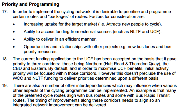
Wellington Cycling Framework and Priorities
- Sustainable Wellington Transport
- Since my post yesterday regarding the cycling framework, there has been a fair bit of discussion around project priorities and, specifically, what this means for the Island Bay Cycleway.
- Accepted from Sustainable Wellington Transport posts
- Tagged as:
- island-bay
- island-bay-cycle-way
Island Bay, Wellington, Wellington City, Wellington, New Zealand/Aotearoa (OpenStreetMap)
-
-
-
Taking it seriously: the Island Bay cycleway
- Wellington Scoop
- Accepted from Wellington Scoop features
- Tagged as:
- island-bay-cycle-way
- island-bay
Island Bay, Wellington, Wellington City, Wellington, New Zealand/Aotearoa (OpenStreetMap)
-
-
-
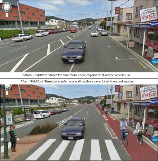
What Riddiford Street could look like
- Wellington Region Cycleways
- This is definitely worth drawing attention to. As I said on my post about the Island Bay cycle routes I am of the opinion that there should be separated cycleways up Adelaide Road and up Riddiford Street (amongst many others). At the Sexify Blog they’re much of the same opinion, at least about Riddiford Street. […]
- Accepted from Wellington Region Cycleways by feedreader
- Tagged as:
- island-bay
- island-bay-cycle-way
Island Bay, Wellington, Wellington City, Wellington, New Zealand/Aotearoa (OpenStreetMap)
-


